
H13A Challis, ID, USA - Earthquake Result Viewer
| ||||||||||||||||||
| ||||||||||||||||||
| ||||||||||||||||||
|
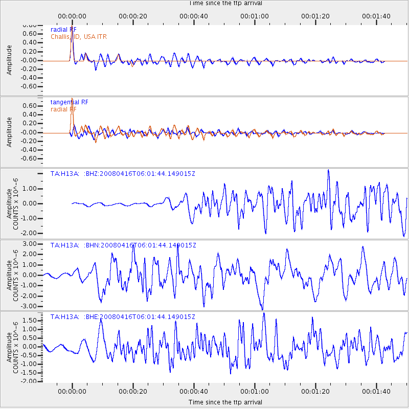
Signal To Noise
| Channel | StoN | STA | LTA |
| TA:H13A: :BHN:20080416T06:01:44.149015Z | 3.6567314 | 4.0942243E-7 | 1.1196405E-7 |
| TA:H13A: :BHE:20080416T06:01:44.149015Z | 2.9717038 | 3.0111042E-7 | 1.0132585E-7 |
| TA:H13A: :BHZ:20080416T06:01:44.149015Z | 3.6732993 | 2.7213042E-7 | 7.408338E-8 |
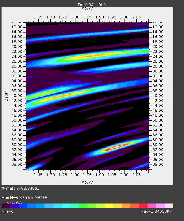
| Arrivals | |
| Ps | 9.5 SECOND |
| PpPs | 26 SECOND |
| PsPs/PpSs | 35 SECOND |

