You are here: Home > Network List > TA - USArray Transportable Network (new EarthScope stations) Stations List
> Station H13A Challis, ID, USA > Earthquake Result Viewer
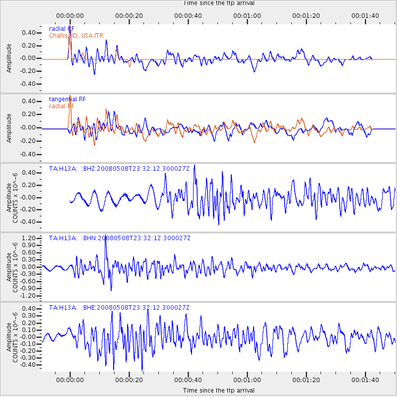
H13A Challis, ID, USA - Earthquake Result Viewer
*The percent match for this event was below the threshold and hence no stack was calculated.
| Earthquake location: |
Near East Coast Of Honshu, Japan |
| Earthquake latitude/longitude: |
36.1/141.7 |
| Earthquake time(UTC): |
2008/05/08 (129) 23:21:06 GMT |
| Earthquake Depth: |
17 km |
| Earthquake Magnitude: |
5.6 MB, 5.2 MS, 5.6 MW, 5.5 MW |
| Earthquake Catalog/Contributor: |
WHDF/NEIC |
|
| Network: |
TA USArray Transportable Network (new EarthScope stations) |
| Station: |
H13A Challis, ID, USA |
| Lat/Lon: |
44.56 N/114.25 W |
| Elevation: |
1563 m |
|
| Distance: |
74.4 deg |
| Az: |
46.06 deg |
| Baz: |
305.34 deg |
| Ray Param: |
$rayparam |
*The percent match for this event was below the threshold and hence was not used in the summary stack. |
|
| Radial Match: |
62.658077 % |
| Radial Bump: |
400 |
| Transverse Match: |
55.741394 % |
| Transverse Bump: |
400 |
| SOD ConfigId: |
2504 |
| Insert Time: |
2010-03-06 14:08:17.292 +0000 |
| GWidth: |
2.5 |
| Max Bumps: |
400 |
| Tol: |
0.001 |
|
Signal To Noise
| Channel | StoN | STA | LTA |
| TA:H13A: :BHN:20080508T23:32:12.300027Z | 3.9578407 | 2.2307638E-7 | 5.6363156E-8 |
| TA:H13A: :BHE:20080508T23:32:12.300027Z | 2.3169906 | 1.12415314E-7 | 4.8517812E-8 |
| TA:H13A: :BHZ:20080508T23:32:12.300027Z | 2.1602256 | 1.6744167E-7 | 7.7511196E-8 |
| Arrivals |
| Ps | |
| PpPs | |
| PsPs/PpSs | |


