You are here: Home > Network List > TA - USArray Transportable Network (new EarthScope stations) Stations List
> Station H13A Challis, ID, USA > Earthquake Result Viewer
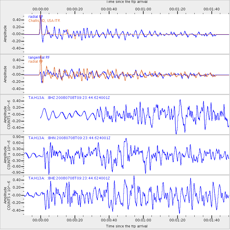
H13A Challis, ID, USA - Earthquake Result Viewer
*The percent match for this event was below the threshold and hence no stack was calculated.
| Earthquake location: |
Southern Peru |
| Earthquake latitude/longitude: |
-16.0/-71.7 |
| Earthquake time(UTC): |
2008/07/08 (190) 09:13:07 GMT |
| Earthquake Depth: |
123 km |
| Earthquake Magnitude: |
5.8 MB, 6.2 MW, 6.2 MW |
| Earthquake Catalog/Contributor: |
WHDF/NEIC |
|
| Network: |
TA USArray Transportable Network (new EarthScope stations) |
| Station: |
H13A Challis, ID, USA |
| Lat/Lon: |
44.56 N/114.25 W |
| Elevation: |
1563 m |
|
| Distance: |
71.6 deg |
| Az: |
329.405 deg |
| Baz: |
136.777 deg |
| Ray Param: |
$rayparam |
*The percent match for this event was below the threshold and hence was not used in the summary stack. |
|
| Radial Match: |
70.215324 % |
| Radial Bump: |
400 |
| Transverse Match: |
68.86743 % |
| Transverse Bump: |
376 |
| SOD ConfigId: |
2504 |
| Insert Time: |
2010-03-06 14:08:28.399 +0000 |
| GWidth: |
2.5 |
| Max Bumps: |
400 |
| Tol: |
0.001 |
|
Signal To Noise
| Channel | StoN | STA | LTA |
| TA:H13A: :BHN:20080708T09:23:44.624001Z | 4.4395123 | 2.8828006E-7 | 6.493508E-8 |
| TA:H13A: :BHE:20080708T09:23:44.624001Z | 3.0367103 | 1.4564851E-7 | 4.79626E-8 |
| TA:H13A: :BHZ:20080708T09:23:44.624001Z | 0.96834093 | 7.86051E-8 | 8.1175024E-8 |
| Arrivals |
| Ps | |
| PpPs | |
| PsPs/PpSs | |


