You are here: Home > Network List > TA - USArray Transportable Network (new EarthScope stations) Stations List
> Station H13A Challis, ID, USA > Earthquake Result Viewer
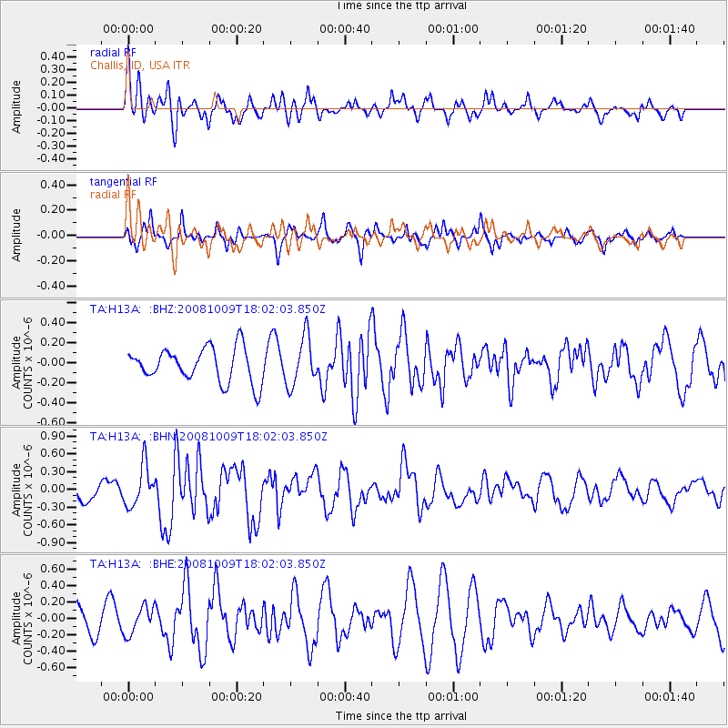
H13A Challis, ID, USA - Earthquake Result Viewer
*The percent match for this event was below the threshold and hence no stack was calculated.
| Earthquake location: |
Tonga Islands |
| Earthquake latitude/longitude: |
-21.0/-174.4 |
| Earthquake time(UTC): |
2008/10/09 (283) 17:49:58 GMT |
| Earthquake Depth: |
10 km |
| Earthquake Magnitude: |
5.8 MB, 5.6 MS, 5.9 MW, 5.9 MW |
| Earthquake Catalog/Contributor: |
WHDF/NEIC |
|
| Network: |
TA USArray Transportable Network (new EarthScope stations) |
| Station: |
H13A Challis, ID, USA |
| Lat/Lon: |
44.56 N/114.25 W |
| Elevation: |
1563 m |
|
| Distance: |
85.3 deg |
| Az: |
38.478 deg |
| Baz: |
234.407 deg |
| Ray Param: |
$rayparam |
*The percent match for this event was below the threshold and hence was not used in the summary stack. |
|
| Radial Match: |
60.121845 % |
| Radial Bump: |
391 |
| Transverse Match: |
60.81485 % |
| Transverse Bump: |
360 |
| SOD ConfigId: |
2556 |
| Insert Time: |
2010-03-06 14:08:41.488 +0000 |
| GWidth: |
2.5 |
| Max Bumps: |
400 |
| Tol: |
0.001 |
|
Signal To Noise
| Channel | StoN | STA | LTA |
| TA:H13A: :BHN:20081009T18:02:03.850Z | 1.8229299 | 3.4943827E-7 | 1.9169046E-7 |
| TA:H13A: :BHE:20081009T18:02:03.850Z | 1.196702 | 1.6810124E-7 | 1.4047043E-7 |
| TA:H13A: :BHZ:20081009T18:02:03.850Z | 1.4545661 | 2.4580967E-7 | 1.6899175E-7 |
| Arrivals |
| Ps | |
| PpPs | |
| PsPs/PpSs | |


