You are here: Home > Network List > TA - USArray Transportable Network (new EarthScope stations) Stations List
> Station H13A Challis, ID, USA > Earthquake Result Viewer
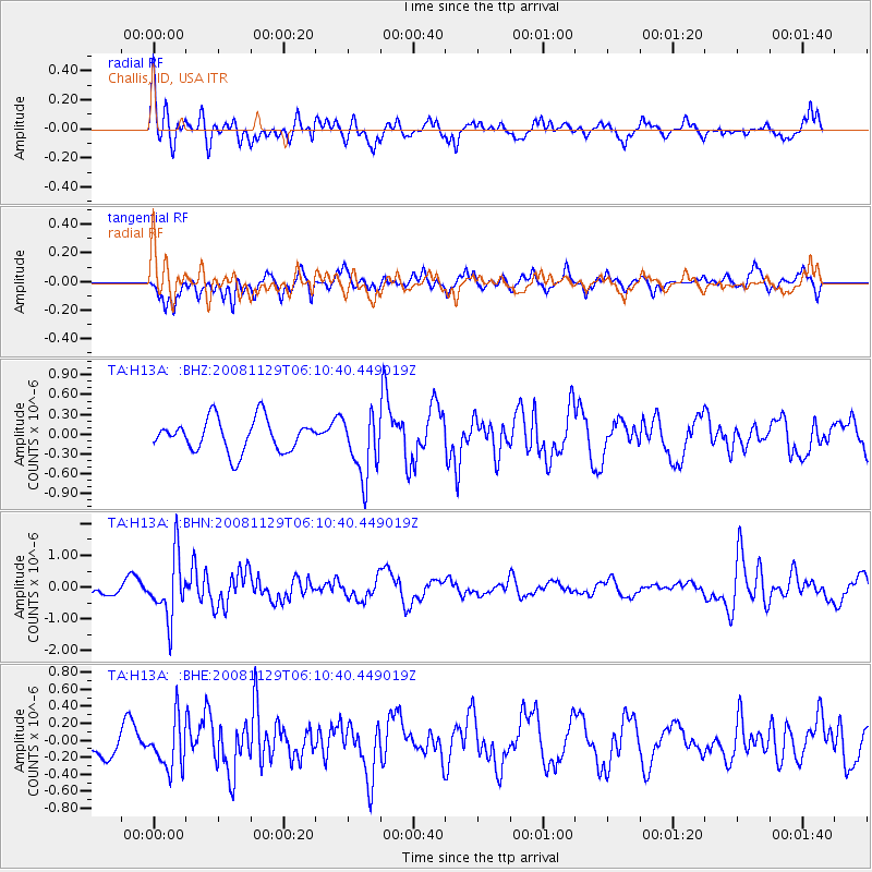
H13A Challis, ID, USA - Earthquake Result Viewer
*The percent match for this event was below the threshold and hence no stack was calculated.
| Earthquake location: |
Fiji Islands Region |
| Earthquake latitude/longitude: |
-18.7/-177.7 |
| Earthquake time(UTC): |
2008/11/29 (334) 05:59:16 GMT |
| Earthquake Depth: |
386 km |
| Earthquake Magnitude: |
5.7 MB, 6.0 MW, 5.9 MW |
| Earthquake Catalog/Contributor: |
WHDF/NEIC |
|
| Network: |
TA USArray Transportable Network (new EarthScope stations) |
| Station: |
H13A Challis, ID, USA |
| Lat/Lon: |
44.56 N/114.25 W |
| Elevation: |
1563 m |
|
| Distance: |
85.4 deg |
| Az: |
39.907 deg |
| Baz: |
238.288 deg |
| Ray Param: |
$rayparam |
*The percent match for this event was below the threshold and hence was not used in the summary stack. |
|
| Radial Match: |
64.92246 % |
| Radial Bump: |
349 |
| Transverse Match: |
60.590973 % |
| Transverse Bump: |
382 |
| SOD ConfigId: |
2658 |
| Insert Time: |
2010-03-06 14:09:02.849 +0000 |
| GWidth: |
2.5 |
| Max Bumps: |
400 |
| Tol: |
0.001 |
|
Signal To Noise
| Channel | StoN | STA | LTA |
| TA:H13A: :BHN:20081129T06:10:40.449019Z | 4.209763 | 9.617819E-7 | 2.2846463E-7 |
| TA:H13A: :BHE:20081129T06:10:40.449019Z | 1.4263177 | 2.8586712E-7 | 2.0042316E-7 |
| TA:H13A: :BHZ:20081129T06:10:40.449019Z | 1.9503245 | 4.75948E-7 | 2.4403528E-7 |
| Arrivals |
| Ps | |
| PpPs | |
| PsPs/PpSs | |


