You are here: Home > Network List > TA - USArray Transportable Network (new EarthScope stations) Stations List
> Station H13A Challis, ID, USA > Earthquake Result Viewer
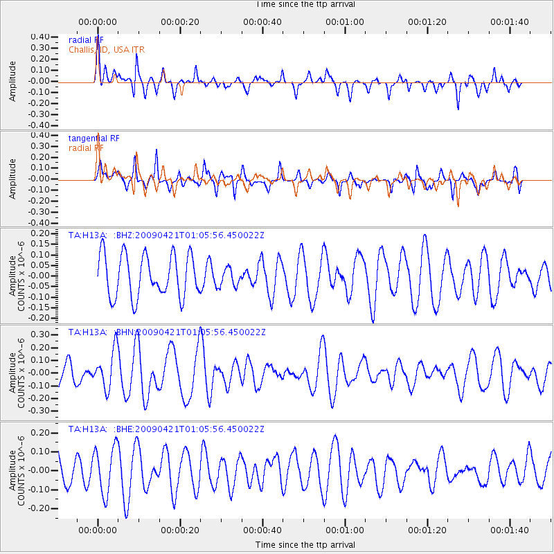
H13A Challis, ID, USA - Earthquake Result Viewer
*The percent match for this event was below the threshold and hence no stack was calculated.
| Earthquake location: |
Vanuatu Islands |
| Earthquake latitude/longitude: |
-19.8/169.9 |
| Earthquake time(UTC): |
2009/04/21 (111) 00:53:13 GMT |
| Earthquake Depth: |
36 km |
| Earthquake Magnitude: |
5.6 MB, 5.3 MS, 5.8 MW, 5.6 MW |
| Earthquake Catalog/Contributor: |
WHDF/NEIC |
|
| Network: |
TA USArray Transportable Network (new EarthScope stations) |
| Station: |
H13A Challis, ID, USA |
| Lat/Lon: |
44.56 N/114.25 W |
| Elevation: |
1563 m |
|
| Distance: |
94.0 deg |
| Az: |
44.004 deg |
| Baz: |
246.244 deg |
| Ray Param: |
$rayparam |
*The percent match for this event was below the threshold and hence was not used in the summary stack. |
|
| Radial Match: |
56.2806 % |
| Radial Bump: |
400 |
| Transverse Match: |
48.212635 % |
| Transverse Bump: |
371 |
| SOD ConfigId: |
2658 |
| Insert Time: |
2010-03-06 14:09:10.370 +0000 |
| GWidth: |
2.5 |
| Max Bumps: |
400 |
| Tol: |
0.001 |
|
Signal To Noise
| Channel | StoN | STA | LTA |
| TA:H13A: :BHN:20090421T01:05:56.450022Z | 2.3206766 | 1.5547447E-7 | 6.699532E-8 |
| TA:H13A: :BHE:20090421T01:05:56.450022Z | 1.7646184 | 1.2623934E-7 | 7.1539176E-8 |
| TA:H13A: :BHZ:20090421T01:05:56.450022Z | 0.43267992 | 4.3117446E-8 | 9.965206E-8 |
| Arrivals |
| Ps | |
| PpPs | |
| PsPs/PpSs | |


