You are here: Home > Network List > TA - USArray Transportable Network (new EarthScope stations) Stations List
> Station H13A Challis, ID, USA > Earthquake Result Viewer
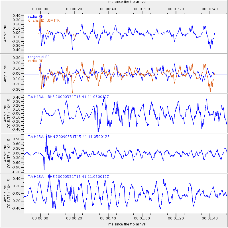
H13A Challis, ID, USA - Earthquake Result Viewer
*The percent match for this event was below the threshold and hence no stack was calculated.
| Earthquake location: |
Mariana Islands |
| Earthquake latitude/longitude: |
18.3/145.7 |
| Earthquake time(UTC): |
2009/03/31 (090) 15:29:31 GMT |
| Earthquake Depth: |
188 km |
| Earthquake Magnitude: |
5.5 MW, 5.4 MB, 5.4 MW |
| Earthquake Catalog/Contributor: |
WHDF/NEIC |
|
| Network: |
TA USArray Transportable Network (new EarthScope stations) |
| Station: |
H13A Challis, ID, USA |
| Lat/Lon: |
44.56 N/114.25 W |
| Elevation: |
1563 m |
|
| Distance: |
84.3 deg |
| Az: |
45.028 deg |
| Baz: |
289.917 deg |
| Ray Param: |
$rayparam |
*The percent match for this event was below the threshold and hence was not used in the summary stack. |
|
| Radial Match: |
59.707848 % |
| Radial Bump: |
400 |
| Transverse Match: |
43.373703 % |
| Transverse Bump: |
326 |
| SOD ConfigId: |
2658 |
| Insert Time: |
2010-03-06 14:09:24.834 +0000 |
| GWidth: |
2.5 |
| Max Bumps: |
400 |
| Tol: |
0.001 |
|
Signal To Noise
| Channel | StoN | STA | LTA |
| TA:H13A: :BHN:20090331T15:41:11.050012Z | 5.3837175 | 4.2288963E-7 | 7.854974E-8 |
| TA:H13A: :BHE:20090331T15:41:11.050012Z | 2.0110614 | 1.9474456E-7 | 9.683671E-8 |
| TA:H13A: :BHZ:20090331T15:41:11.050012Z | 1.5867003 | 1.9829328E-7 | 1.249721E-7 |
| Arrivals |
| Ps | |
| PpPs | |
| PsPs/PpSs | |


