You are here: Home > Network List > TA - USArray Transportable Network (new EarthScope stations) Stations List
> Station H13A Challis, ID, USA > Earthquake Result Viewer
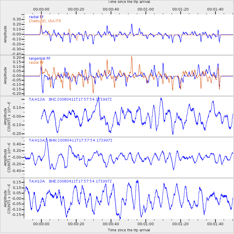
H13A Challis, ID, USA - Earthquake Result Viewer
*The percent match for this event was below the threshold and hence no stack was calculated.
| Earthquake location: |
Loyalty Islands |
| Earthquake latitude/longitude: |
-20.4/168.8 |
| Earthquake time(UTC): |
2008/04/11 (102) 17:45:05 GMT |
| Earthquake Depth: |
35 km |
| Earthquake Magnitude: |
5.7 MB, 5.9 MS, 6.0 MW, 6.0 MW |
| Earthquake Catalog/Contributor: |
WHDF/NEIC |
|
| Network: |
TA USArray Transportable Network (new EarthScope stations) |
| Station: |
H13A Challis, ID, USA |
| Lat/Lon: |
44.56 N/114.25 W |
| Elevation: |
1563 m |
|
| Distance: |
95.2 deg |
| Az: |
44.361 deg |
| Baz: |
246.562 deg |
| Ray Param: |
$rayparam |
*The percent match for this event was below the threshold and hence was not used in the summary stack. |
|
| Radial Match: |
55.675396 % |
| Radial Bump: |
349 |
| Transverse Match: |
48.57565 % |
| Transverse Bump: |
400 |
| SOD ConfigId: |
2504 |
| Insert Time: |
2010-03-06 14:09:31.175 +0000 |
| GWidth: |
2.5 |
| Max Bumps: |
400 |
| Tol: |
0.001 |
|
Signal To Noise
| Channel | StoN | STA | LTA |
| TA:H13A: :BHN:20080411T17:57:54.173997Z | 2.648006 | 2.554566E-7 | 9.647131E-8 |
| TA:H13A: :BHE:20080411T17:57:54.173997Z | 0.7375712 | 4.956944E-8 | 6.7206315E-8 |
| TA:H13A: :BHZ:20080411T17:57:54.173997Z | 1.8974639 | 1.17954286E-7 | 6.2164176E-8 |
| Arrivals |
| Ps | |
| PpPs | |
| PsPs/PpSs | |


