You are here: Home > Network List > TA - USArray Transportable Network (new EarthScope stations) Stations List
> Station H13A Challis, ID, USA > Earthquake Result Viewer
H13A Challis, ID, USA - Earthquake Result Viewer
*The percent match for this event was below the threshold and hence no stack was calculated.
| Earthquake location: |
Solomon Islands |
| Earthquake latitude/longitude: |
-8.9/157.8 |
| Earthquake time(UTC): |
2008/06/22 (174) 07:22:06 GMT |
| Earthquake Depth: |
10 km |
| Earthquake Magnitude: |
5.5 MB, 5.5 MS, 5.8 MW, 5.7 MW |
| Earthquake Catalog/Contributor: |
WHDF/NEIC |
|
| Network: |
TA USArray Transportable Network (new EarthScope stations) |
| Station: |
H13A Challis, ID, USA |
| Lat/Lon: |
44.56 N/114.25 W |
| Elevation: |
1563 m |
|
| Distance: |
94.7 deg |
| Az: |
45.787 deg |
| Baz: |
262.259 deg |
| Ray Param: |
$rayparam |
*The percent match for this event was below the threshold and hence was not used in the summary stack. |
|
| Radial Match: |
50.21846 % |
| Radial Bump: |
400 |
| Transverse Match: |
48.464443 % |
| Transverse Bump: |
400 |
| SOD ConfigId: |
2504 |
| Insert Time: |
2010-03-06 14:09:38.358 +0000 |
| GWidth: |
2.5 |
| Max Bumps: |
400 |
| Tol: |
0.001 |
|
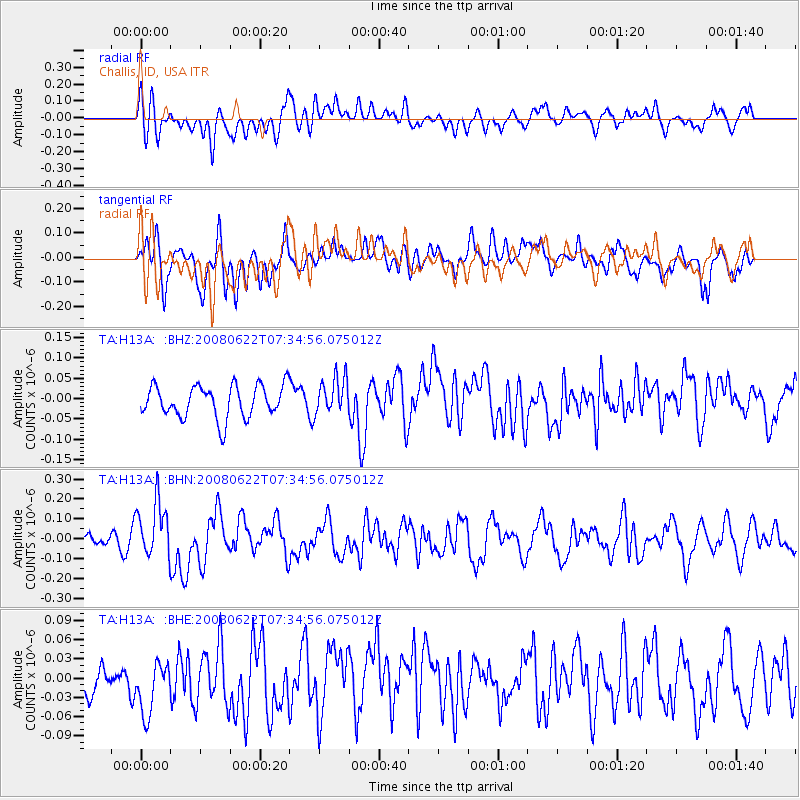
Signal To Noise
| Channel | StoN | STA | LTA |
| TA:H13A: :BHN:20080622T07:34:56.075012Z | 4.935962 | 1.3933109E-7 | 2.8227747E-8 |
| TA:H13A: :BHE:20080622T07:34:56.075012Z | 1.0081475 | 5.320568E-8 | 5.2775693E-8 |
| TA:H13A: :BHZ:20080622T07:34:56.075012Z | 1.1306815 | 4.480458E-8 | 3.9626173E-8 |
| Arrivals |
| Ps | |
| PpPs | |
| PsPs/PpSs | |


