You are here: Home > Network List > TA - USArray Transportable Network (new EarthScope stations) Stations List
> Station H13A Challis, ID, USA > Earthquake Result Viewer
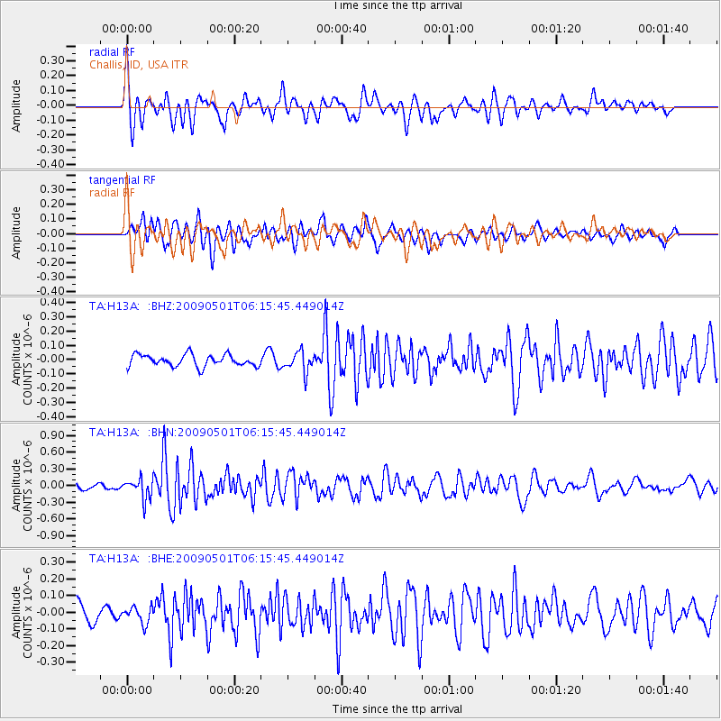
H13A Challis, ID, USA - Earthquake Result Viewer
*The percent match for this event was below the threshold and hence no stack was calculated.
| Earthquake location: |
Solomon Islands |
| Earthquake latitude/longitude: |
-10.8/162.2 |
| Earthquake time(UTC): |
2009/05/01 (121) 06:03:05 GMT |
| Earthquake Depth: |
21 km |
| Earthquake Magnitude: |
5.9 MB, 5.6 MS, 5.9 MW, 5.9 MW |
| Earthquake Catalog/Contributor: |
WHDF/NEIC |
|
| Network: |
TA USArray Transportable Network (new EarthScope stations) |
| Station: |
H13A Challis, ID, USA |
| Lat/Lon: |
44.56 N/114.25 W |
| Elevation: |
1563 m |
|
| Distance: |
92.9 deg |
| Az: |
45.33 deg |
| Baz: |
257.851 deg |
| Ray Param: |
$rayparam |
*The percent match for this event was below the threshold and hence was not used in the summary stack. |
|
| Radial Match: |
71.74918 % |
| Radial Bump: |
400 |
| Transverse Match: |
70.01268 % |
| Transverse Bump: |
400 |
| SOD ConfigId: |
2658 |
| Insert Time: |
2010-03-06 14:09:42.617 +0000 |
| GWidth: |
2.5 |
| Max Bumps: |
400 |
| Tol: |
0.001 |
|
Signal To Noise
| Channel | StoN | STA | LTA |
| TA:H13A: :BHN:20090501T06:15:45.449014Z | 2.8132255 | 1.8032551E-7 | 6.4099204E-8 |
| TA:H13A: :BHE:20090501T06:15:45.449014Z | 1.0717142 | 4.968043E-8 | 4.6356043E-8 |
| TA:H13A: :BHZ:20090501T06:15:45.449014Z | 1.7652571 | 7.174389E-8 | 4.0642178E-8 |
| Arrivals |
| Ps | |
| PpPs | |
| PsPs/PpSs | |


