F13A Darby, MT, USA - Earthquake Result Viewer
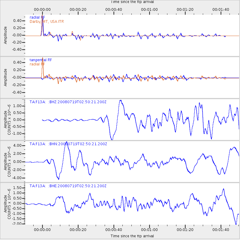
Earthquake location: Off East Coast Of Honshu, Japan
Earthquake latitude/longitude: 37.6/142.2
Earthquake time(UTC): 2008/07/19 (201) 02:39:28 GMT
Earthquake Depth: 22 km
Earthquake Magnitude: 6.2 MB, 7.0 MS, 7.0 MW, 6.9 MW
Earthquake Catalog/Contributor: WHDF/NEIC
Network: TA USArray Transportable Network (new EarthScope stations)
Station: F13A Darby, MT, USA
Lat/Lon: 45.79 N/114.33 W
Elevation: 1462 m
Distance: 72.3 deg
Az: 45.59 deg
Baz: 305.765 deg
Ray Param: 0.053734783
Estimated Moho Depth: 44.25 km
Estimated Crust Vp/Vs: 1.60
Assumed Crust Vp: 6.577 km/s
Estimated Crust Vs: 4.111 km/s
Estimated Crust Poisson's Ratio: 0.18
Radial Match: 95.168396 %
Radial Bump: 400
Transverse Match: 81.08859 %
Transverse Bump: 400
SOD ConfigId: 2504
Insert Time: 2010-03-06 14:10:05.021 +0000
GWidth: 2.5
Max Bumps: 400
Tol: 0.001

Signal To Noise

ChannelStoNSTALTA
TA:F13A: :BHN:20080719T02:50:21.200Z4.9849553.0775396E-76.173656E-8
TA:F13A: :BHE:20080719T02:50:21.200Z2.82691348.365627E-82.9592794E-8
TA:F13A: :BHZ:20080719T02:50:21.200Z2.3117551.00355E-74.3410743E-8
Arrivals
Ps4.2 SECOND
PpPs17 SECOND
PsPs/PpSs21 SECOND