F13A Darby, MT, USA - Earthquake Result Viewer
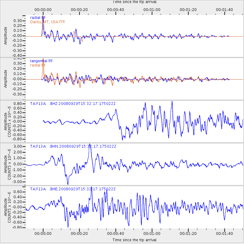
Earthquake location: Kermadec Islands, New Zealand
Earthquake latitude/longitude: -29.8/-177.7
Earthquake time(UTC): 2008/09/29 (273) 15:19:31 GMT
Earthquake Depth: 36 km
Earthquake Magnitude: 6.5 MB, 6.7 MS, 7.0 MW, 7.0 MW
Earthquake Catalog/Contributor: WHDF/NEIC
Network: TA USArray Transportable Network (new EarthScope stations)
Station: F13A Darby, MT, USA
Lat/Lon: 45.79 N/114.33 W
Elevation: 1462 m
Distance: 94.6 deg
Az: 38.857 deg
Baz: 231.233 deg
Ray Param: 0.040992934
Estimated Moho Depth: 36.25 km
Estimated Crust Vp/Vs: 1.88
Assumed Crust Vp: 6.577 km/s
Estimated Crust Vs: 3.498 km/s
Estimated Crust Poisson's Ratio: 0.30
Radial Match: 94.52242 %
Radial Bump: 400
Transverse Match: 84.4418 %
Transverse Bump: 400
SOD ConfigId: 2560
Insert Time: 2010-03-06 14:10:36.596 +0000
GWidth: 2.5
Max Bumps: 400
Tol: 0.001

Signal To Noise

ChannelStoNSTALTA
TA:F13A: :BHN:20080929T15:32:17.175022Z12.0064936.218674E-75.1794263E-8
TA:F13A: :BHE:20080929T15:32:17.175022Z2.05677961.2297666E-75.979088E-8
TA:F13A: :BHZ:20080929T15:32:17.175022Z2.70861741.2796866E-74.724501E-8
Arrivals
Ps4.9 SECOND
PpPs16 SECOND
PsPs/PpSs21 SECOND