You are here: Home > Network List > TA - USArray Transportable Network (new EarthScope stations) Stations List
> Station F13A Darby, MT, USA > Earthquake Result Viewer
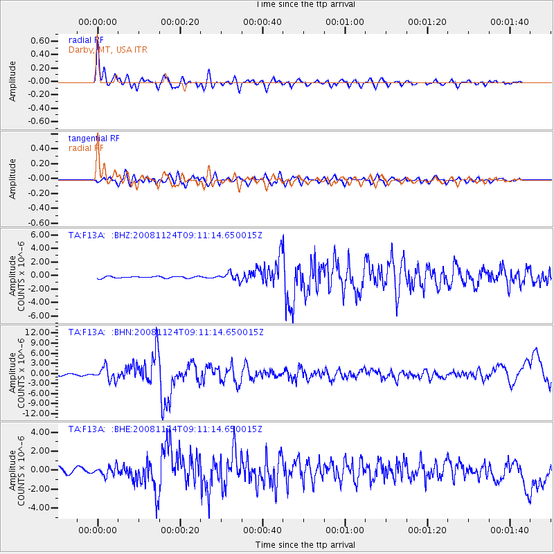
F13A Darby, MT, USA - Earthquake Result Viewer

| Earthquake location: |
Sea Of Okhotsk |
| Earthquake latitude/longitude: |
54.2/154.3 |
| Earthquake time(UTC): |
2008/11/24 (329) 09:02:58 GMT |
| Earthquake Depth: |
492 km |
| Earthquake Magnitude: |
6.5 MB, 7.3 MW, 7.3 MW |
| Earthquake Catalog/Contributor: |
WHDF/NEIC |
|
| Network: |
TA USArray Transportable Network (new EarthScope stations) |
| Station: |
F13A Darby, MT, USA |
| Lat/Lon: |
45.79 N/114.33 W |
| Elevation: |
1462 m |
|
| Distance: |
55.4 deg |
| Az: |
58.24 deg |
| Baz: |
314.445 deg |
| Ray Param: |
0.06285565 |
| Estimated Moho Depth: |
24.0 km |
| Estimated Crust Vp/Vs: |
2.07 |
| Assumed Crust Vp: |
6.577 km/s |
| Estimated Crust Vs: |
3.177 km/s |
| Estimated Crust Poisson's Ratio: |
0.35 |
|
| Radial Match: |
85.26654 % |
| Radial Bump: |
400 |
| Transverse Match: |
59.98355 % |
| Transverse Bump: |
400 |
| SOD ConfigId: |
2658 |
| Insert Time: |
2010-03-06 14:10:51.699 +0000 |
| GWidth: |
2.5 |
| Max Bumps: |
400 |
| Tol: |
0.001 |
|
Signal To Noise
| Channel | StoN | STA | LTA |
| TA:F13A: :BHN:20081124T09:11:14.650015Z | 12.617187 | 1.9652512E-6 | 1.5575986E-7 |
| TA:F13A: :BHE:20081124T09:11:14.650015Z | 1.9441738 | 4.846131E-7 | 2.492643E-7 |
| TA:F13A: :BHZ:20081124T09:11:14.650015Z | 4.3383493 | 5.59461E-7 | 1.2895713E-7 |
| Arrivals |
| Ps | 4.1 SECOND |
| PpPs | 11 SECOND |
| PsPs/PpSs | 15 SECOND |


