F13A Darby, MT, USA - Earthquake Result Viewer
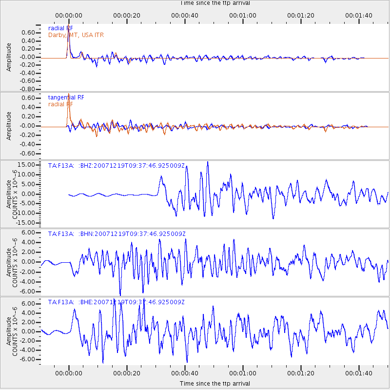
Earthquake location: Andreanof Islands, Aleutian Is.
Earthquake latitude/longitude: 51.4/-179.5
Earthquake time(UTC): 2007/12/19 (353) 09:30:27 GMT
Earthquake Depth: 29 km
Earthquake Magnitude: 6.4 MB, 7.1 MS, 7.1 MW, 7.0 MW
Earthquake Catalog/Contributor: WHDF/NEIC
Network: TA USArray Transportable Network (new EarthScope stations)
Station: F13A Darby, MT, USA
Lat/Lon: 45.79 N/114.33 W
Elevation: 1462 m
Distance: 42.2 deg
Az: 70.961 deg
Baz: 302.113 deg
Ray Param: 0.07325357
Estimated Moho Depth: 44.5 km
Estimated Crust Vp/Vs: 1.60
Assumed Crust Vp: 6.577 km/s
Estimated Crust Vs: 4.104 km/s
Estimated Crust Poisson's Ratio: 0.18
Radial Match: 93.20065 %
Radial Bump: 400
Transverse Match: 85.84758 %
Transverse Bump: 400
SOD ConfigId: 2564
Insert Time: 2010-03-06 14:11:01.734 +0000
GWidth: 2.5
Max Bumps: 400
Tol: 0.001

Signal To Noise

ChannelStoNSTALTA
TA:F13A: :BHN:20071219T09:37:46.925009Z4.5885691.3965866E-63.0436212E-7
TA:F13A: :BHE:20071219T09:37:46.925009Z9.1765442.4116148E-62.6280205E-7
TA:F13A: :BHZ:20071219T09:37:46.925009Z11.7343954.714594E-64.0177562E-7
Arrivals
Ps4.4 SECOND
PpPs16 SECOND
PsPs/PpSs21 SECOND