You are here: Home > Network List > TA - USArray Transportable Network (new EarthScope stations) Stations List
> Station F13A Darby, MT, USA > Earthquake Result Viewer
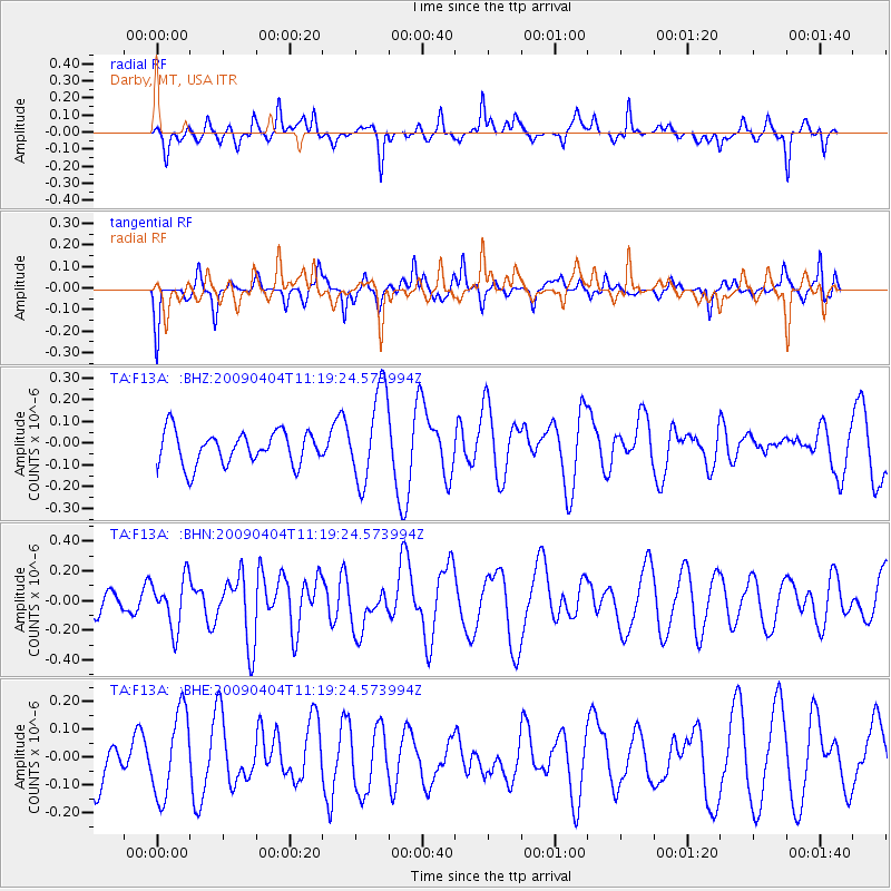
F13A Darby, MT, USA - Earthquake Result Viewer
*The percent match for this event was below the threshold and hence no stack was calculated.
| Earthquake location: |
Tonga Islands Region |
| Earthquake latitude/longitude: |
-22.5/-174.7 |
| Earthquake time(UTC): |
2009/04/04 (094) 11:07:12 GMT |
| Earthquake Depth: |
35 km |
| Earthquake Magnitude: |
5.5 MB, 5.4 MS, 5.5 MW, 5.5 MW |
| Earthquake Catalog/Contributor: |
WHDF/NEIC |
|
| Network: |
TA USArray Transportable Network (new EarthScope stations) |
| Station: |
F13A Darby, MT, USA |
| Lat/Lon: |
45.79 N/114.33 W |
| Elevation: |
1462 m |
|
| Distance: |
87.2 deg |
| Az: |
37.491 deg |
| Baz: |
233.547 deg |
| Ray Param: |
$rayparam |
*The percent match for this event was below the threshold and hence was not used in the summary stack. |
|
| Radial Match: |
50.28779 % |
| Radial Bump: |
368 |
| Transverse Match: |
67.92543 % |
| Transverse Bump: |
301 |
| SOD ConfigId: |
2658 |
| Insert Time: |
2010-03-06 14:14:54.984 +0000 |
| GWidth: |
2.5 |
| Max Bumps: |
400 |
| Tol: |
0.001 |
|
Signal To Noise
| Channel | StoN | STA | LTA |
| TA:F13A: :BHN:20090404T11:19:24.573994Z | 1.6616288 | 1.6739119E-7 | 1.0073922E-7 |
| TA:F13A: :BHE:20090404T11:19:24.573994Z | 1.3308781 | 1.5158484E-7 | 1.1389836E-7 |
| TA:F13A: :BHZ:20090404T11:19:24.573994Z | 2.7997296 | 2.120391E-7 | 7.5735564E-8 |
| Arrivals |
| Ps | |
| PpPs | |
| PsPs/PpSs | |


