You are here: Home > Network List > GS - US Geological Survey Networks Stations List
> Station KAN08 Pence Farm, Harper, KS, USA > Earthquake Result Viewer
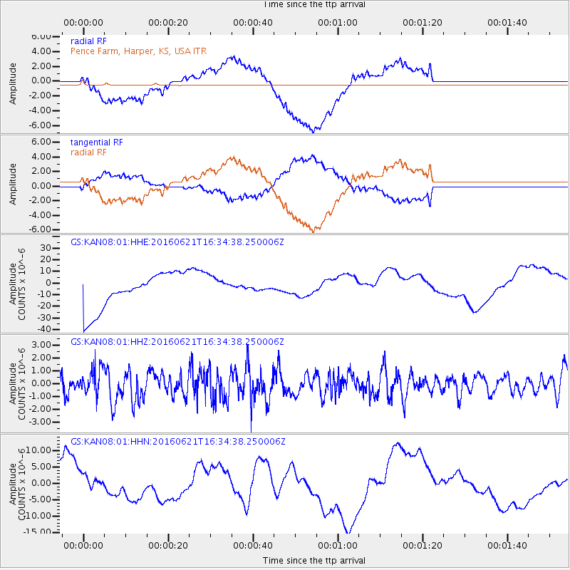
KAN08 Pence Farm, Harper, KS, USA - Earthquake Result Viewer
*The percent match for this event was below the threshold and hence no stack was calculated.
| Earthquake location: |
Northern Mid-Atlantic Ridge |
| Earthquake latitude/longitude: |
22.7/-45.1 |
| Earthquake time(UTC): |
2016/06/21 (173) 16:26:34 GMT |
| Earthquake Depth: |
10 km |
| Earthquake Magnitude: |
6.1 MWB |
| Earthquake Catalog/Contributor: |
NEIC PDE/NEIC COMCAT |
|
| Network: |
GS US Geological Survey Networks |
| Station: |
KAN08 Pence Farm, Harper, KS, USA |
| Lat/Lon: |
37.23 N/97.97 W |
| Elevation: |
375 m |
|
| Distance: |
47.5 deg |
| Az: |
300.301 deg |
| Baz: |
92.361 deg |
| Ray Param: |
$rayparam |
*The percent match for this event was below the threshold and hence was not used in the summary stack. |
|
| Radial Match: |
46.99407 % |
| Radial Bump: |
400 |
| Transverse Match: |
33.701 % |
| Transverse Bump: |
400 |
| SOD ConfigId: |
1634031 |
| Insert Time: |
2016-07-05 16:28:02.428 +0000 |
| GWidth: |
2.5 |
| Max Bumps: |
400 |
| Tol: |
0.001 |
|
Signal To Noise
| Channel | StoN | STA | LTA |
| GS:KAN08:01:HHZ:20160621T16:34:38.250006Z | 1.7929883 | 9.672709E-7 | 5.394742E-7 |
| GS:KAN08:01:HHN:20160621T16:34:38.250006Z | 0.59550256 | 7.0729593E-6 | 1.1877295E-5 |
| GS:KAN08:01:HHE:20160621T16:34:38.250006Z | 0.6487706 | 1.00199295E-5 | 1.544449E-5 |
| Arrivals |
| Ps | |
| PpPs | |
| PsPs/PpSs | |


