You are here: Home > Network List > TA - USArray Transportable Network (new EarthScope stations) Stations List
> Station F14A Wisdom, MT, USA > Earthquake Result Viewer
F14A Wisdom, MT, USA - Earthquake Result Viewer

| Earthquake location: |
North Of Honduras |
| Earthquake latitude/longitude: |
17.2/-84.8 |
| Earthquake time(UTC): |
2008/03/27 (087) 09:42:57 GMT |
| Earthquake Depth: |
10 km |
| Earthquake Magnitude: |
5.6 MW, 5.1 MS, 5.4 MB, 5.6 MW |
| Earthquake Catalog/Contributor: |
WHDF/NEIC |
|
| Network: |
TA USArray Transportable Network (new EarthScope stations) |
| Station: |
F14A Wisdom, MT, USA |
| Lat/Lon: |
45.81 N/113.37 W |
| Elevation: |
1851 m |
|
| Distance: |
37.1 deg |
| Az: |
326.384 deg |
| Baz: |
130.836 deg |
| Ray Param: |
0.07630866 |
| Estimated Moho Depth: |
16.25 km |
| Estimated Crust Vp/Vs: |
1.96 |
| Assumed Crust Vp: |
6.577 km/s |
| Estimated Crust Vs: |
3.351 km/s |
| Estimated Crust Poisson's Ratio: |
0.32 |
|
| Radial Match: |
82.43232 % |
| Radial Bump: |
400 |
| Transverse Match: |
75.95754 % |
| Transverse Bump: |
400 |
| SOD ConfigId: |
2564 |
| Insert Time: |
2010-03-06 14:16:31.244 +0000 |
| GWidth: |
2.5 |
| Max Bumps: |
400 |
| Tol: |
0.001 |
|
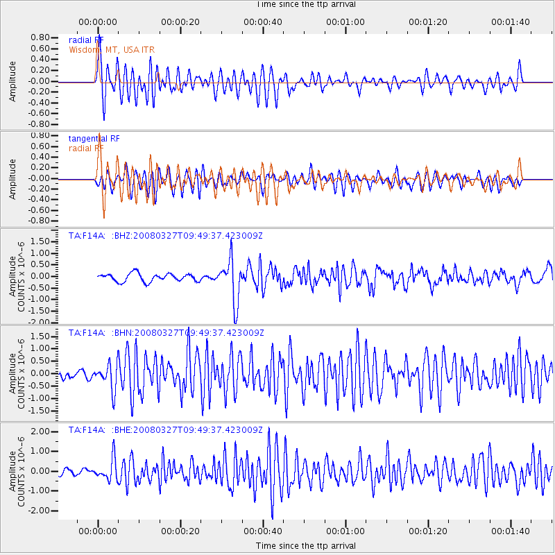
Signal To Noise
| Channel | StoN | STA | LTA |
| TA:F14A: :BHN:20080327T09:49:37.423009Z | 2.2896788 | 5.352871E-7 | 2.3378261E-7 |
| TA:F14A: :BHE:20080327T09:49:37.423009Z | 3.288019 | 5.5555313E-7 | 1.6896287E-7 |
| TA:F14A: :BHZ:20080327T09:49:37.423009Z | 5.461227 | 9.406789E-7 | 1.722468E-7 |
| Arrivals |
| Ps | 2.6 SECOND |
| PpPs | 6.8 SECOND |
| PsPs/PpSs | 9.4 SECOND |


