
F14A Wisdom, MT, USA - Earthquake Result Viewer
| ||||||||||||||||||
| ||||||||||||||||||
| ||||||||||||||||||
|
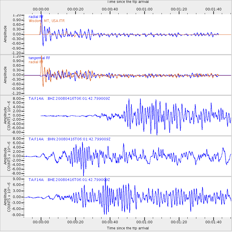
Signal To Noise
| Channel | StoN | STA | LTA |
| TA:F14A: :BHN:20080416T06:01:42.799009Z | 7.4527345 | 7.8650356E-7 | 1.05532216E-7 |
| TA:F14A: :BHE:20080416T06:01:42.799009Z | 2.3390143 | 3.9403352E-7 | 1.6846134E-7 |
| TA:F14A: :BHZ:20080416T06:01:42.799009Z | 2.8451936 | 3.0826692E-7 | 1.0834655E-7 |
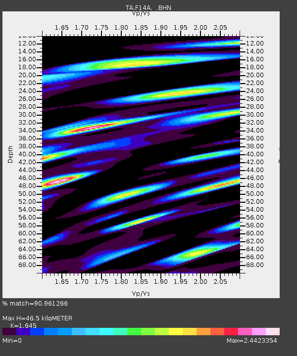
| Arrivals | |
| Ps | 4.9 SECOND |
| PpPs | 17 SECOND |
| PsPs/PpSs | 22 SECOND |

