You are here: Home > Network List > AV - Alaska Volcano Observatory Stations List
> Station SPCR Ckakachatna River, Mount Spurr, Alaska > Earthquake Result Viewer
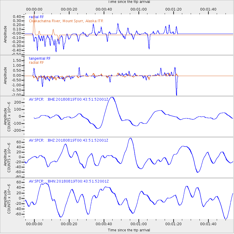
SPCR Ckakachatna River, Mount Spurr, Alaska - Earthquake Result Viewer
*The percent match for this event was below the threshold and hence no stack was calculated.
| Earthquake location: |
Fiji Islands Region |
| Earthquake latitude/longitude: |
-17.9/-178.2 |
| Earthquake time(UTC): |
2018/08/19 (231) 00:32:59 GMT |
| Earthquake Depth: |
520 km |
| Earthquake Magnitude: |
5.7 mb |
| Earthquake Catalog/Contributor: |
NEIC PDE/us |
|
| Network: |
AV Alaska Volcano Observatory |
| Station: |
SPCR Ckakachatna River, Mount Spurr, Alaska |
| Lat/Lon: |
61.20 N/152.21 W |
| Elevation: |
984 m |
|
| Distance: |
81.6 deg |
| Az: |
12.387 deg |
| Baz: |
204.944 deg |
| Ray Param: |
$rayparam |
*The percent match for this event was below the threshold and hence was not used in the summary stack. |
|
| Radial Match: |
32.97495 % |
| Radial Bump: |
246 |
| Transverse Match: |
51.853306 % |
| Transverse Bump: |
260 |
| SOD ConfigId: |
13570011 |
| Insert Time: |
2019-04-30 21:19:10.341 +0000 |
| GWidth: |
2.5 |
| Max Bumps: |
400 |
| Tol: |
0.001 |
|
Signal To Noise
| Channel | StoN | STA | LTA |
| AV:SPCR: :BHZ:20180819T00:43:51.52001Z | 0.3577442 | 5.7831126E-6 | 1.6165497E-5 |
| AV:SPCR: :BHN:20180819T00:43:51.52001Z | 1.9766783 | 3.2744512E-5 | 1.6565424E-5 |
| AV:SPCR: :BHE:20180819T00:43:51.52001Z | 4.5664005 | 7.6475524E-5 | 1.674744E-5 |
| Arrivals |
| Ps | |
| PpPs | |
| PsPs/PpSs | |


