You are here: Home > Network List > TA - USArray Transportable Network (new EarthScope stations) Stations List
> Station F14A Wisdom, MT, USA > Earthquake Result Viewer
F14A Wisdom, MT, USA - Earthquake Result Viewer
*The percent match for this event was below the threshold and hence no stack was calculated.
| Earthquake location: |
South Of Mariana Islands |
| Earthquake latitude/longitude: |
12.5/143.2 |
| Earthquake time(UTC): |
2008/05/09 (130) 21:51:29 GMT |
| Earthquake Depth: |
76 km |
| Earthquake Magnitude: |
6.1 MB, 6.7 MW, 6.7 MW |
| Earthquake Catalog/Contributor: |
WHDF/NEIC |
|
| Network: |
TA USArray Transportable Network (new EarthScope stations) |
| Station: |
F14A Wisdom, MT, USA |
| Lat/Lon: |
45.81 N/113.37 W |
| Elevation: |
1851 m |
|
| Distance: |
90.3 deg |
| Az: |
42.863 deg |
| Baz: |
288.236 deg |
| Ray Param: |
$rayparam |
*The percent match for this event was below the threshold and hence was not used in the summary stack. |
|
| Radial Match: |
71.192856 % |
| Radial Bump: |
400 |
| Transverse Match: |
67.15118 % |
| Transverse Bump: |
400 |
| SOD ConfigId: |
2504 |
| Insert Time: |
2010-03-06 14:18:44.326 +0000 |
| GWidth: |
2.5 |
| Max Bumps: |
400 |
| Tol: |
0.001 |
|
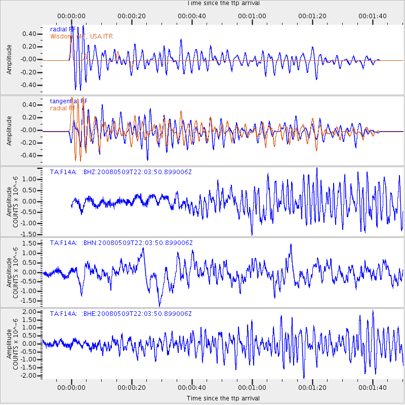
Signal To Noise
| Channel | StoN | STA | LTA |
| TA:F14A: :BHN:20080509T22:03:50.899006Z | 3.9379542 | 4.528159E-7 | 1.149876E-7 |
| TA:F14A: :BHE:20080509T22:03:50.899006Z | 1.3082253 | 1.7321487E-7 | 1.3240448E-7 |
| TA:F14A: :BHZ:20080509T22:03:50.899006Z | 1.3405185 | 2.1018826E-7 | 1.5679623E-7 |
| Arrivals |
| Ps | |
| PpPs | |
| PsPs/PpSs | |


