You are here: Home > Network List > TA - USArray Transportable Network (new EarthScope stations) Stations List
> Station G16K Koyuk River, AK, USA > Earthquake Result Viewer
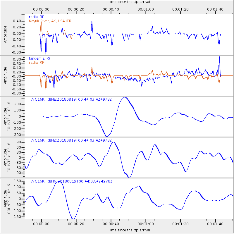
G16K Koyuk River, AK, USA - Earthquake Result Viewer
*The percent match for this event was below the threshold and hence no stack was calculated.
| Earthquake location: |
Fiji Islands Region |
| Earthquake latitude/longitude: |
-17.9/-178.2 |
| Earthquake time(UTC): |
2018/08/19 (231) 00:32:59 GMT |
| Earthquake Depth: |
520 km |
| Earthquake Magnitude: |
5.7 mb |
| Earthquake Catalog/Contributor: |
NEIC PDE/us |
|
| Network: |
TA USArray Transportable Network (new EarthScope stations) |
| Station: |
G16K Koyuk River, AK, USA |
| Lat/Lon: |
65.39 N/162.35 W |
| Elevation: |
169 m |
|
| Distance: |
84.0 deg |
| Az: |
6.602 deg |
| Baz: |
195.152 deg |
| Ray Param: |
$rayparam |
*The percent match for this event was below the threshold and hence was not used in the summary stack. |
|
| Radial Match: |
66.4747 % |
| Radial Bump: |
307 |
| Transverse Match: |
15.011855 % |
| Transverse Bump: |
400 |
| SOD ConfigId: |
13570011 |
| Insert Time: |
2019-04-30 21:22:54.053 +0000 |
| GWidth: |
2.5 |
| Max Bumps: |
400 |
| Tol: |
0.001 |
|
Signal To Noise
| Channel | StoN | STA | LTA |
| TA:G16K: :BHZ:20180819T00:44:03.424978Z | 1.6301737 | 3.6072728E-5 | 2.212815E-5 |
| TA:G16K: :BHN:20180819T00:44:03.424978Z | 1.3914175 | 2.6790402E-5 | 1.9254036E-5 |
| TA:G16K: :BHE:20180819T00:44:03.424978Z | 5.2213383 | 8.465931E-5 | 1.6214102E-5 |
| Arrivals |
| Ps | |
| PpPs | |
| PsPs/PpSs | |


