You are here: Home > Network List > TA - USArray Transportable Network (new EarthScope stations) Stations List
> Station F14A Wisdom, MT, USA > Earthquake Result Viewer
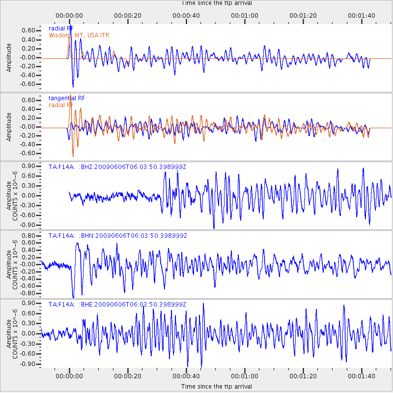
F14A Wisdom, MT, USA - Earthquake Result Viewer
*The percent match for this event was below the threshold and hence no stack was calculated.
| Earthquake location: |
Near East Coast Of Honshu, Japan |
| Earthquake latitude/longitude: |
35.5/140.9 |
| Earthquake time(UTC): |
2009/06/06 (157) 05:52:43 GMT |
| Earthquake Depth: |
34 km |
| Earthquake Magnitude: |
5.8 MB, 5.4 MS, 5.8 MW, 5.7 MW |
| Earthquake Catalog/Contributor: |
WHDF/NEIC |
|
| Network: |
TA USArray Transportable Network (new EarthScope stations) |
| Station: |
F14A Wisdom, MT, USA |
| Lat/Lon: |
45.81 N/113.37 W |
| Elevation: |
1851 m |
|
| Distance: |
75.0 deg |
| Az: |
44.182 deg |
| Baz: |
305.587 deg |
| Ray Param: |
$rayparam |
*The percent match for this event was below the threshold and hence was not used in the summary stack. |
|
| Radial Match: |
75.59608 % |
| Radial Bump: |
400 |
| Transverse Match: |
69.53226 % |
| Transverse Bump: |
400 |
| SOD ConfigId: |
2648 |
| Insert Time: |
2010-03-06 14:19:30.472 +0000 |
| GWidth: |
2.5 |
| Max Bumps: |
400 |
| Tol: |
0.001 |
|
Signal To Noise
| Channel | StoN | STA | LTA |
| TA:F14A: :BHN:20090606T06:03:50.398999Z | 7.2226067 | 4.6850076E-7 | 6.486588E-8 |
| TA:F14A: :BHE:20090606T06:03:50.398999Z | 2.0273283 | 1.7054899E-7 | 8.412499E-8 |
| TA:F14A: :BHZ:20090606T06:03:50.398999Z | 4.076457 | 3.28835E-7 | 8.0666865E-8 |
| Arrivals |
| Ps | |
| PpPs | |
| PsPs/PpSs | |


