You are here: Home > Network List > TA - USArray Transportable Network (new EarthScope stations) Stations List
> Station I17K Unalakleet, AK, USA > Earthquake Result Viewer
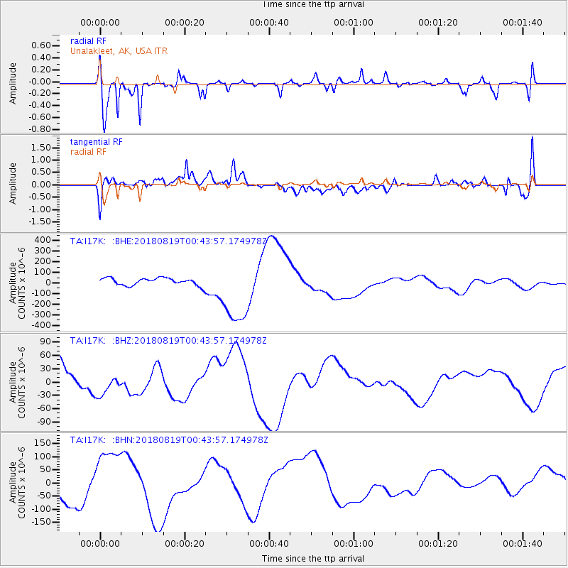
I17K Unalakleet, AK, USA - Earthquake Result Viewer
*The percent match for this event was below the threshold and hence no stack was calculated.
| Earthquake location: |
Fiji Islands Region |
| Earthquake latitude/longitude: |
-17.9/-178.2 |
| Earthquake time(UTC): |
2018/08/19 (231) 00:32:59 GMT |
| Earthquake Depth: |
520 km |
| Earthquake Magnitude: |
5.7 mb |
| Earthquake Catalog/Contributor: |
NEIC PDE/us |
|
| Network: |
TA USArray Transportable Network (new EarthScope stations) |
| Station: |
I17K Unalakleet, AK, USA |
| Lat/Lon: |
63.89 N/160.70 W |
| Elevation: |
105 m |
|
| Distance: |
82.7 deg |
| Az: |
7.713 deg |
| Baz: |
196.779 deg |
| Ray Param: |
$rayparam |
*The percent match for this event was below the threshold and hence was not used in the summary stack. |
|
| Radial Match: |
64.01203 % |
| Radial Bump: |
332 |
| Transverse Match: |
25.383692 % |
| Transverse Bump: |
400 |
| SOD ConfigId: |
13570011 |
| Insert Time: |
2019-04-30 21:22:59.691 +0000 |
| GWidth: |
2.5 |
| Max Bumps: |
400 |
| Tol: |
0.001 |
|
Signal To Noise
| Channel | StoN | STA | LTA |
| TA:I17K: :BHZ:20180819T00:43:57.174978Z | 0.7289902 | 2.2714225E-5 | 3.1158477E-5 |
| TA:I17K: :BHN:20180819T00:43:57.174978Z | 2.6072412 | 1.17032134E-4 | 4.4887347E-5 |
| TA:I17K: :BHE:20180819T00:43:57.174978Z | 9.329643 | 3.2648238E-4 | 3.499409E-5 |
| Arrivals |
| Ps | |
| PpPs | |
| PsPs/PpSs | |


