You are here: Home > Network List > TA - USArray Transportable Network (new EarthScope stations) Stations List
> Station L15K Ungalak Mountain, AK, USA > Earthquake Result Viewer
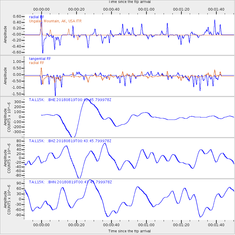
L15K Ungalak Mountain, AK, USA - Earthquake Result Viewer
*The percent match for this event was below the threshold and hence no stack was calculated.
| Earthquake location: |
Fiji Islands Region |
| Earthquake latitude/longitude: |
-17.9/-178.2 |
| Earthquake time(UTC): |
2018/08/19 (231) 00:32:59 GMT |
| Earthquake Depth: |
520 km |
| Earthquake Magnitude: |
5.7 mb |
| Earthquake Catalog/Contributor: |
NEIC PDE/us |
|
| Network: |
TA USArray Transportable Network (new EarthScope stations) |
| Station: |
L15K Ungalak Mountain, AK, USA |
| Lat/Lon: |
61.68 N/161.49 W |
| Elevation: |
219 m |
|
| Distance: |
80.5 deg |
| Az: |
7.994 deg |
| Baz: |
196.117 deg |
| Ray Param: |
$rayparam |
*The percent match for this event was below the threshold and hence was not used in the summary stack. |
|
| Radial Match: |
72.16295 % |
| Radial Bump: |
286 |
| Transverse Match: |
49.47835 % |
| Transverse Bump: |
171 |
| SOD ConfigId: |
13570011 |
| Insert Time: |
2019-04-30 21:23:08.870 +0000 |
| GWidth: |
2.5 |
| Max Bumps: |
400 |
| Tol: |
0.001 |
|
Signal To Noise
| Channel | StoN | STA | LTA |
| TA:L15K: :BHZ:20180819T00:43:45.799978Z | 0.4804093 | 1.5226223E-5 | 3.169427E-5 |
| TA:L15K: :BHN:20180819T00:43:45.799978Z | 0.679231 | 4.0752686E-5 | 5.9998274E-5 |
| TA:L15K: :BHE:20180819T00:43:45.799978Z | 1.2208076 | 2.3079482E-4 | 1.8905094E-4 |
| Arrivals |
| Ps | |
| PpPs | |
| PsPs/PpSs | |


