You are here: Home > Network List > TA - USArray Transportable Network (new EarthScope stations) Stations List
> Station C16K Lisburne Hills, AK, USA > Earthquake Result Viewer
C16K Lisburne Hills, AK, USA - Earthquake Result Viewer
*The percent match for this event was below the threshold and hence no stack was calculated.
| Earthquake location: |
Fiji Islands Region |
| Earthquake latitude/longitude: |
-17.9/-178.0 |
| Earthquake time(UTC): |
2018/08/19 (231) 00:39:07 GMT |
| Earthquake Depth: |
576 km |
| Earthquake Magnitude: |
5.7 mb |
| Earthquake Catalog/Contributor: |
NEIC PDE/us |
|
| Network: |
TA USArray Transportable Network (new EarthScope stations) |
| Station: |
C16K Lisburne Hills, AK, USA |
| Lat/Lon: |
68.27 N/165.34 W |
| Elevation: |
102 m |
|
| Distance: |
86.4 deg |
| Az: |
4.683 deg |
| Baz: |
192.053 deg |
| Ray Param: |
$rayparam |
*The percent match for this event was below the threshold and hence was not used in the summary stack. |
|
| Radial Match: |
56.117313 % |
| Radial Bump: |
400 |
| Transverse Match: |
47.988167 % |
| Transverse Bump: |
284 |
| SOD ConfigId: |
13570011 |
| Insert Time: |
2019-04-30 21:29:45.659 +0000 |
| GWidth: |
2.5 |
| Max Bumps: |
400 |
| Tol: |
0.001 |
|
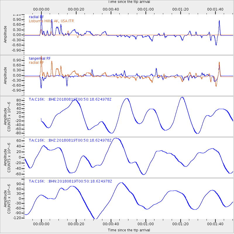
Signal To Noise
| Channel | StoN | STA | LTA |
| TA:C16K: :BHZ:20180819T00:50:18.624978Z | 2.4563928 | 4.4229513E-5 | 1.800588E-5 |
| TA:C16K: :BHN:20180819T00:50:18.624978Z | 0.46512944 | 2.5186666E-5 | 5.41498E-5 |
| TA:C16K: :BHE:20180819T00:50:18.624978Z | 1.3428724 | 5.765876E-5 | 4.293689E-5 |
| Arrivals |
| Ps | |
| PpPs | |
| PsPs/PpSs | |


