You are here: Home > Network List > TA - USArray Transportable Network (new EarthScope stations) Stations List
> Station J26L Joseph Creek, AK, USA > Earthquake Result Viewer
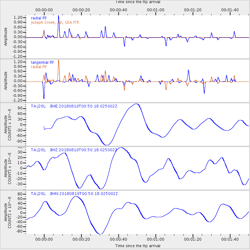
J26L Joseph Creek, AK, USA - Earthquake Result Viewer
*The percent match for this event was below the threshold and hence no stack was calculated.
| Earthquake location: |
Fiji Islands Region |
| Earthquake latitude/longitude: |
-17.9/-178.0 |
| Earthquake time(UTC): |
2018/08/19 (231) 00:39:07 GMT |
| Earthquake Depth: |
576 km |
| Earthquake Magnitude: |
5.7 mb |
| Earthquake Catalog/Contributor: |
NEIC PDE/us |
|
| Network: |
TA USArray Transportable Network (new EarthScope stations) |
| Station: |
J26L Joseph Creek, AK, USA |
| Lat/Lon: |
64.50 N/143.56 W |
| Elevation: |
1144 m |
|
| Distance: |
86.3 deg |
| Az: |
14.194 deg |
| Baz: |
212.64 deg |
| Ray Param: |
$rayparam |
*The percent match for this event was below the threshold and hence was not used in the summary stack. |
|
| Radial Match: |
41.820442 % |
| Radial Bump: |
174 |
| Transverse Match: |
31.363241 % |
| Transverse Bump: |
218 |
| SOD ConfigId: |
13570011 |
| Insert Time: |
2019-04-30 21:30:24.369 +0000 |
| GWidth: |
2.5 |
| Max Bumps: |
400 |
| Tol: |
0.001 |
|
Signal To Noise
| Channel | StoN | STA | LTA |
| TA:J26L: :BHZ:20180819T00:50:18.025002Z | 1.4959079 | 1.8689454E-5 | 1.249372E-5 |
| TA:J26L: :BHN:20180819T00:50:18.025002Z | 0.9524044 | 4.7578746E-5 | 4.9956456E-5 |
| TA:J26L: :BHE:20180819T00:50:18.025002Z | 4.5489826 | 1.1536494E-4 | 2.5360603E-5 |
| Arrivals |
| Ps | |
| PpPs | |
| PsPs/PpSs | |


