You are here: Home > Network List > US - United States National Seismic Network Stations List
> Station MSO Missoula, Montana, USA > Earthquake Result Viewer
MSO Missoula, Montana, USA - Earthquake Result Viewer
*The percent match for this event was below the threshold and hence no stack was calculated.
| Earthquake location: |
Northern Mid-Atlantic Ridge |
| Earthquake latitude/longitude: |
22.7/-45.1 |
| Earthquake time(UTC): |
2016/06/21 (173) 16:26:34 GMT |
| Earthquake Depth: |
10 km |
| Earthquake Magnitude: |
6.1 MWB |
| Earthquake Catalog/Contributor: |
NEIC PDE/NEIC COMCAT |
|
| Network: |
US United States National Seismic Network |
| Station: |
MSO Missoula, Montana, USA |
| Lat/Lon: |
46.83 N/113.94 W |
| Elevation: |
1264 m |
|
| Distance: |
59.5 deg |
| Az: |
312.002 deg |
| Baz: |
88.652 deg |
| Ray Param: |
$rayparam |
*The percent match for this event was below the threshold and hence was not used in the summary stack. |
|
| Radial Match: |
61.314697 % |
| Radial Bump: |
400 |
| Transverse Match: |
51.165867 % |
| Transverse Bump: |
400 |
| SOD ConfigId: |
1634031 |
| Insert Time: |
2016-07-05 16:34:10.738 +0000 |
| GWidth: |
2.5 |
| Max Bumps: |
400 |
| Tol: |
0.001 |
|
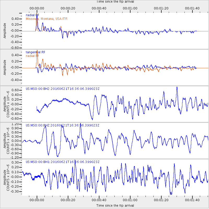
Signal To Noise
| Channel | StoN | STA | LTA |
| US:MSO:00:BHZ:20160621T16:36:06.399023Z | 6.0501065 | 3.6279303E-7 | 5.9964734E-8 |
| US:MSO:00:BH1:20160621T16:36:06.399023Z | 0.31856686 | 3.4336246E-8 | 1.0778349E-7 |
| US:MSO:00:BH2:20160621T16:36:06.399023Z | 1.1067908 | 1.7361369E-7 | 1.5686224E-7 |
| Arrivals |
| Ps | |
| PpPs | |
| PsPs/PpSs | |


