You are here: Home > Network List > TA - USArray Transportable Network (new EarthScope stations) Stations List
> Station T25A Trinidad, CO, USA > Earthquake Result Viewer
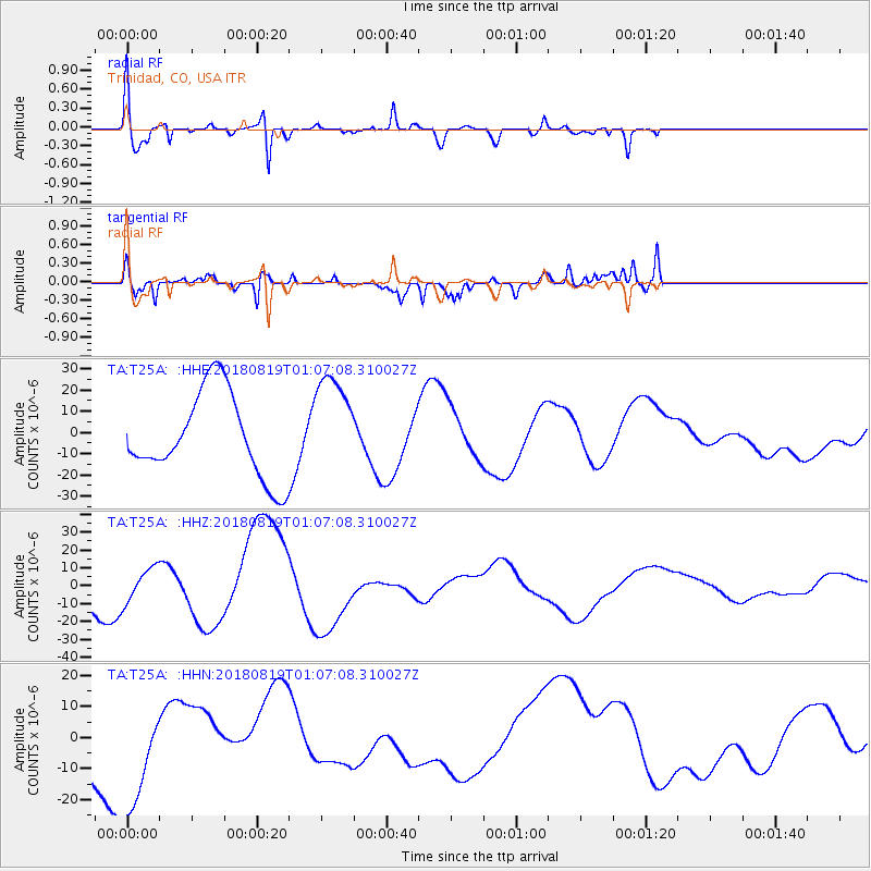
T25A Trinidad, CO, USA - Earthquake Result Viewer
*The percent match for this event was below the threshold and hence no stack was calculated.
| Earthquake location: |
Fiji Islands Region |
| Earthquake latitude/longitude: |
-18.2/-178.1 |
| Earthquake time(UTC): |
2018/08/19 (231) 00:55:44 GMT |
| Earthquake Depth: |
538 km |
| Earthquake Magnitude: |
5.6 mb |
| Earthquake Catalog/Contributor: |
NEIC PDE/us |
|
| Network: |
TA USArray Transportable Network (new EarthScope stations) |
| Station: |
T25A Trinidad, CO, USA |
| Lat/Lon: |
37.14 N/104.41 W |
| Elevation: |
2017 m |
|
| Distance: |
88.5 deg |
| Az: |
50.105 deg |
| Baz: |
245.853 deg |
| Ray Param: |
$rayparam |
*The percent match for this event was below the threshold and hence was not used in the summary stack. |
|
| Radial Match: |
72.33658 % |
| Radial Bump: |
400 |
| Transverse Match: |
75.88919 % |
| Transverse Bump: |
400 |
| SOD ConfigId: |
13570011 |
| Insert Time: |
2019-04-30 21:36:51.470 +0000 |
| GWidth: |
2.5 |
| Max Bumps: |
400 |
| Tol: |
0.001 |
|
Signal To Noise
| Channel | StoN | STA | LTA |
| TA:T25A: :HHZ:20180819T01:07:08.310027Z | 1.321008 | 9.535619E-6 | 7.218441E-6 |
| TA:T25A: :HHN:20180819T01:07:08.310027Z | 1.8829081 | 1.9238581E-5 | 1.0217483E-5 |
| TA:T25A: :HHE:20180819T01:07:08.310027Z | 1.2228103 | 2.4060106E-5 | 1.9676074E-5 |
| Arrivals |
| Ps | |
| PpPs | |
| PsPs/PpSs | |


