You are here: Home > Network List > CN - Canadian National Seismograph Network Stations List
> Station INK INUVIK, NT > Earthquake Result Viewer
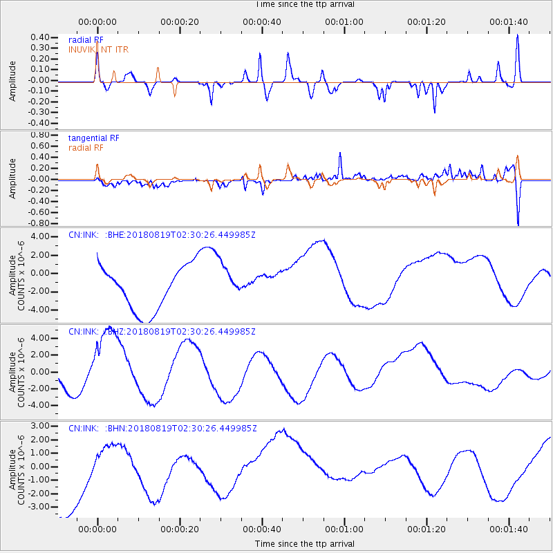
INK INUVIK, NT - Earthquake Result Viewer
*The percent match for this event was below the threshold and hence no stack was calculated.
| Earthquake location: |
Fiji Islands Region |
| Earthquake latitude/longitude: |
-18.3/-178.4 |
| Earthquake time(UTC): |
2018/08/19 (231) 02:18:52 GMT |
| Earthquake Depth: |
618 km |
| Earthquake Magnitude: |
5.7 mb |
| Earthquake Catalog/Contributor: |
NEIC PDE/us |
|
| Network: |
CN Canadian National Seismograph Network |
| Station: |
INK INUVIK, NT |
| Lat/Lon: |
68.31 N/133.53 W |
| Elevation: |
44 m |
|
| Distance: |
92.2 deg |
| Az: |
15.207 deg |
| Baz: |
222.096 deg |
| Ray Param: |
$rayparam |
*The percent match for this event was below the threshold and hence was not used in the summary stack. |
|
| Radial Match: |
34.153023 % |
| Radial Bump: |
264 |
| Transverse Match: |
38.189987 % |
| Transverse Bump: |
340 |
| SOD ConfigId: |
13570011 |
| Insert Time: |
2019-04-30 21:41:01.380 +0000 |
| GWidth: |
2.5 |
| Max Bumps: |
400 |
| Tol: |
0.001 |
|
Signal To Noise
| Channel | StoN | STA | LTA |
| CN:INK: :BHZ:20180819T02:30:26.449985Z | 4.9134645 | 5.3529484E-6 | 1.0894448E-6 |
| CN:INK: :BHN:20180819T02:30:26.449985Z | 0.15066534 | 6.3861023E-7 | 4.238601E-6 |
| CN:INK: :BHE:20180819T02:30:26.449985Z | 0.87496644 | 2.104393E-6 | 2.4051126E-6 |
| Arrivals |
| Ps | |
| PpPs | |
| PsPs/PpSs | |


