You are here: Home > Network List > CI - Caltech Regional Seismic Network Stations List
> Station PHL Parkhill, California, USA > Earthquake Result Viewer
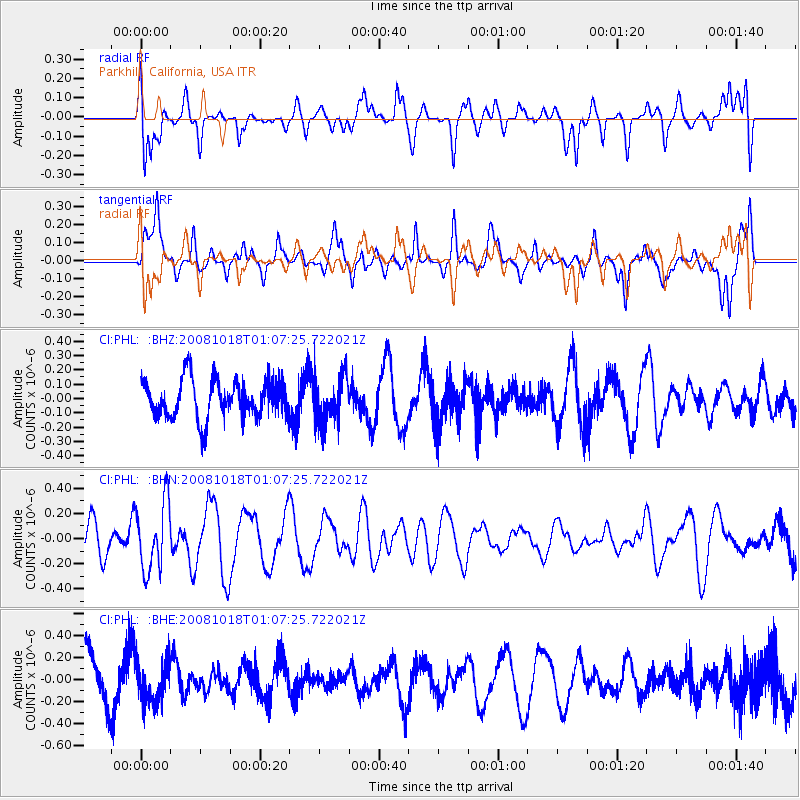
PHL Parkhill, California, USA - Earthquake Result Viewer
*The percent match for this event was below the threshold and hence no stack was calculated.
| Earthquake location: |
Eastern New Guinea Reg., P.N.G. |
| Earthquake latitude/longitude: |
-7.0/147.3 |
| Earthquake time(UTC): |
2008/10/18 (292) 00:54:39 GMT |
| Earthquake Depth: |
77 km |
| Earthquake Magnitude: |
5.8 MB, 5.7 MW, 5.7 MW |
| Earthquake Catalog/Contributor: |
WHDF/NEIC |
|
| Network: |
CI Caltech Regional Seismic Network |
| Station: |
PHL Parkhill, California, USA |
| Lat/Lon: |
35.41 N/120.55 W |
| Elevation: |
351 m |
|
| Distance: |
95.8 deg |
| Az: |
55.127 deg |
| Baz: |
265.598 deg |
| Ray Param: |
$rayparam |
*The percent match for this event was below the threshold and hence was not used in the summary stack. |
|
| Radial Match: |
62.11784 % |
| Radial Bump: |
400 |
| Transverse Match: |
69.55585 % |
| Transverse Bump: |
400 |
| SOD ConfigId: |
2560 |
| Insert Time: |
2010-02-26 02:14:25.059 +0000 |
| GWidth: |
2.5 |
| Max Bumps: |
400 |
| Tol: |
0.001 |
|
Signal To Noise
| Channel | StoN | STA | LTA |
| CI:PHL: :BHN:20081018T01:07:25.722021Z | 2.0872493 | 2.710466E-7 | 1.2985828E-7 |
| CI:PHL: :BHE:20081018T01:07:25.722021Z | 1.0078216 | 1.8519655E-7 | 1.8375925E-7 |
| CI:PHL: :BHZ:20081018T01:07:25.722021Z | 1.2158154 | 1.6173937E-7 | 1.3302954E-7 |
| Arrivals |
| Ps | |
| PpPs | |
| PsPs/PpSs | |


