You are here: Home > Network List > TA - USArray Transportable Network (new EarthScope stations) Stations List
> Station J20K Nowitna River, AK, USA > Earthquake Result Viewer
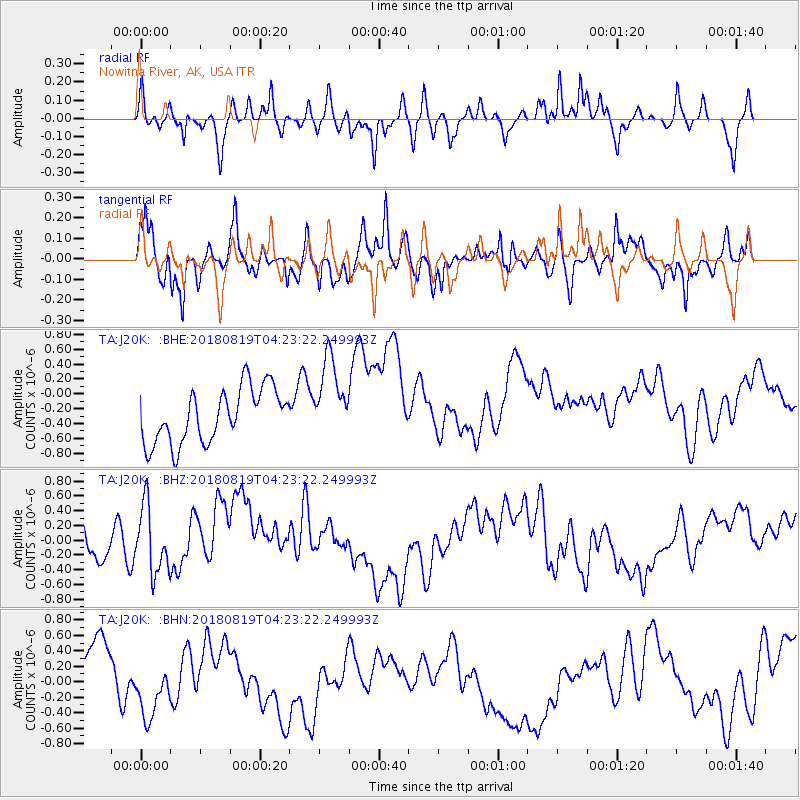
J20K Nowitna River, AK, USA - Earthquake Result Viewer
*The percent match for this event was below the threshold and hence no stack was calculated.
| Earthquake location: |
Sumbawa Region, Indonesia |
| Earthquake latitude/longitude: |
-8.3/116.6 |
| Earthquake time(UTC): |
2018/08/19 (231) 04:10:21 GMT |
| Earthquake Depth: |
7.9 km |
| Earthquake Magnitude: |
6.3 Mww |
| Earthquake Catalog/Contributor: |
NEIC PDE/us |
|
| Network: |
TA USArray Transportable Network (new EarthScope stations) |
| Station: |
J20K Nowitna River, AK, USA |
| Lat/Lon: |
64.18 N/154.15 W |
| Elevation: |
314 m |
|
| Distance: |
97.1 deg |
| Az: |
26.189 deg |
| Baz: |
265.71 deg |
| Ray Param: |
$rayparam |
*The percent match for this event was below the threshold and hence was not used in the summary stack. |
|
| Radial Match: |
37.135902 % |
| Radial Bump: |
282 |
| Transverse Match: |
60.586334 % |
| Transverse Bump: |
384 |
| SOD ConfigId: |
13570011 |
| Insert Time: |
2019-04-30 21:47:20.824 +0000 |
| GWidth: |
2.5 |
| Max Bumps: |
400 |
| Tol: |
0.001 |
|
Signal To Noise
| Channel | StoN | STA | LTA |
| TA:J20K: :BHZ:20180819T04:23:22.249993Z | 1.0702587 | 4.8953126E-7 | 4.5739523E-7 |
| TA:J20K: :BHN:20180819T04:23:22.249993Z | 0.5162552 | 2.8323075E-7 | 5.4862545E-7 |
| TA:J20K: :BHE:20180819T04:23:22.249993Z | 1.5045992 | 5.48904E-7 | 3.648174E-7 |
| Arrivals |
| Ps | |
| PpPs | |
| PsPs/PpSs | |


