You are here: Home > Network List > TA - USArray Transportable Network (new EarthScope stations) Stations List
> Station Z17A San Carlos High School, San Carlos, AZ, USA > Earthquake Result Viewer
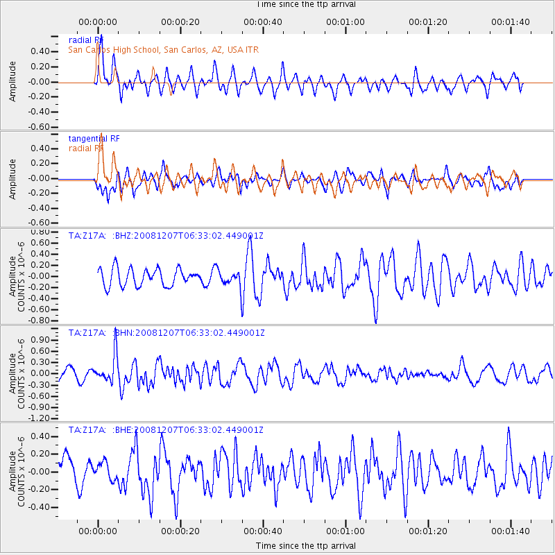
Z17A San Carlos High School, San Carlos, AZ, USA - Earthquake Result Viewer
*The percent match for this event was below the threshold and hence no stack was calculated.
| Earthquake location: |
Northern Mid-Atlantic Ridge |
| Earthquake latitude/longitude: |
13.4/-44.8 |
| Earthquake time(UTC): |
2008/12/07 (342) 06:23:09 GMT |
| Earthquake Depth: |
10 km |
| Earthquake Magnitude: |
5.6 MB, 5.3 MS, 5.7 MW |
| Earthquake Catalog/Contributor: |
WHDF/NEIC |
|
| Network: |
TA USArray Transportable Network (new EarthScope stations) |
| Station: |
Z17A San Carlos High School, San Carlos, AZ, USA |
| Lat/Lon: |
33.30 N/110.47 W |
| Elevation: |
846 m |
|
| Distance: |
62.5 deg |
| Az: |
300.675 deg |
| Baz: |
91.754 deg |
| Ray Param: |
$rayparam |
*The percent match for this event was below the threshold and hence was not used in the summary stack. |
|
| Radial Match: |
64.440575 % |
| Radial Bump: |
400 |
| Transverse Match: |
65.35808 % |
| Transverse Bump: |
400 |
| SOD ConfigId: |
2658 |
| Insert Time: |
2010-03-06 14:23:14.970 +0000 |
| GWidth: |
2.5 |
| Max Bumps: |
400 |
| Tol: |
0.001 |
|
Signal To Noise
| Channel | StoN | STA | LTA |
| TA:Z17A: :BHN:20081207T06:33:02.449001Z | 2.4200332 | 3.857272E-7 | 1.5938922E-7 |
| TA:Z17A: :BHE:20081207T06:33:02.449001Z | 0.48274055 | 1.00854486E-7 | 2.0892067E-7 |
| TA:Z17A: :BHZ:20081207T06:33:02.449001Z | 0.95995027 | 1.4747667E-7 | 1.5362949E-7 |
| Arrivals |
| Ps | |
| PpPs | |
| PsPs/PpSs | |


