Y17A Roosevelt, AZ, USA - Earthquake Result Viewer
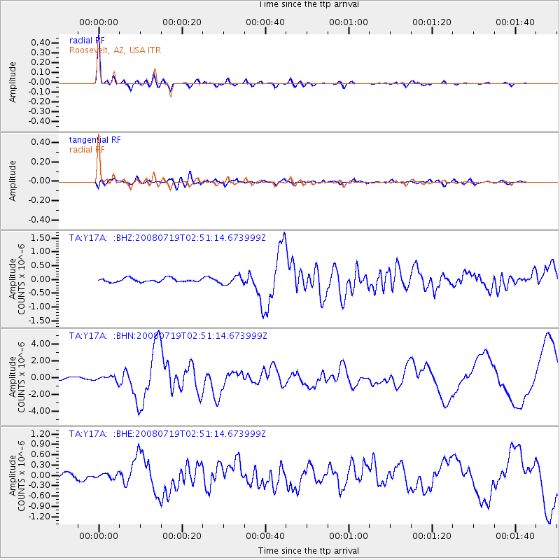
Earthquake location: Off East Coast Of Honshu, Japan
Earthquake latitude/longitude: 37.6/142.2
Earthquake time(UTC): 2008/07/19 (201) 02:39:28 GMT
Earthquake Depth: 22 km
Earthquake Magnitude: 6.2 MB, 7.0 MS, 7.0 MW, 6.9 MW
Earthquake Catalog/Contributor: WHDF/NEIC
Network: TA USArray Transportable Network (new EarthScope stations)
Station: Y17A Roosevelt, AZ, USA
Lat/Lon: 33.70 N/110.84 W
Elevation: 866 m
Distance: 81.8 deg
Az: 53.678 deg
Baz: 309.819 deg
Ray Param: 0.04728643
Estimated Moho Depth: 32.0 km
Estimated Crust Vp/Vs: 1.72
Assumed Crust Vp: 6.276 km/s
Estimated Crust Vs: 3.649 km/s
Estimated Crust Poisson's Ratio: 0.24
Radial Match: 96.20699 %
Radial Bump: 305
Transverse Match: 80.79732 %
Transverse Bump: 400
SOD ConfigId: 2504
Insert Time: 2010-03-06 14:23:48.662 +0000
GWidth: 2.5
Max Bumps: 400
Tol: 0.001

Signal To Noise

ChannelStoNSTALTA
TA:Y17A: :BHN:20080719T02:51:14.673999Z2.4489063.2087922E-71.3102962E-7
TA:Y17A: :BHE:20080719T02:51:14.673999Z0.7776686.968186E-88.960361E-8
TA:Y17A: :BHZ:20080719T02:51:14.673999Z2.14869281.4618712E-76.8035376E-8
Arrivals
Ps3.8 SECOND
PpPs14 SECOND
PsPs/PpSs17 SECOND