You are here: Home > Network List > TA - USArray Transportable Network (new EarthScope stations) Stations List
> Station E20K Nigu River, AK, USA > Earthquake Result Viewer
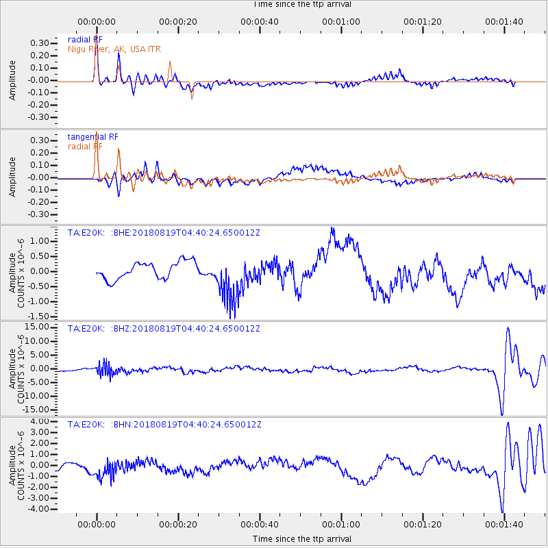
E20K Nigu River, AK, USA - Earthquake Result Viewer
*The percent match for this event was below the threshold and hence no stack was calculated.
| Earthquake location: |
Fiji Islands Region |
| Earthquake latitude/longitude: |
-17.0/-178.0 |
| Earthquake time(UTC): |
2018/08/19 (231) 04:28:58 GMT |
| Earthquake Depth: |
416 km |
| Earthquake Magnitude: |
6.8 mww |
| Earthquake Catalog/Contributor: |
NEIC PDE/us |
|
| Network: |
TA USArray Transportable Network (new EarthScope stations) |
| Station: |
E20K Nigu River, AK, USA |
| Lat/Lon: |
68.26 N/156.19 W |
| Elevation: |
866 m |
|
| Distance: |
86.5 deg |
| Az: |
7.984 deg |
| Baz: |
200.901 deg |
| Ray Param: |
$rayparam |
*The percent match for this event was below the threshold and hence was not used in the summary stack. |
|
| Radial Match: |
70.20043 % |
| Radial Bump: |
400 |
| Transverse Match: |
71.27818 % |
| Transverse Bump: |
400 |
| SOD ConfigId: |
13570011 |
| Insert Time: |
2019-04-30 21:56:33.019 +0000 |
| GWidth: |
2.5 |
| Max Bumps: |
400 |
| Tol: |
0.001 |
|
Signal To Noise
| Channel | StoN | STA | LTA |
| TA:E20K: :BHZ:20180819T04:40:24.650012Z | 4.671934 | 1.8765872E-6 | 4.0167245E-7 |
| TA:E20K: :BHN:20180819T04:40:24.650012Z | 1.6712393 | 1.1336163E-6 | 6.783088E-7 |
| TA:E20K: :BHE:20180819T04:40:24.650012Z | 2.9330652 | 8.303698E-7 | 2.831065E-7 |
| Arrivals |
| Ps | |
| PpPs | |
| PsPs/PpSs | |


