Y17A Roosevelt, AZ, USA - Earthquake Result Viewer
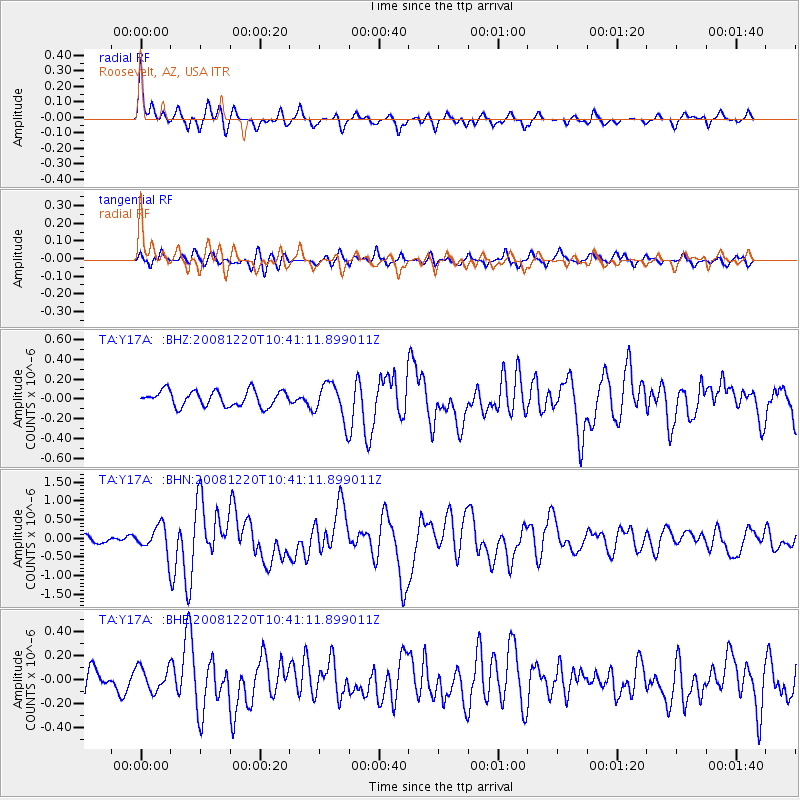
Earthquake location: Off East Coast Of Honshu, Japan
Earthquake latitude/longitude: 36.5/142.4
Earthquake time(UTC): 2008/12/20 (355) 10:29:23 GMT
Earthquake Depth: 19 km
Earthquake Magnitude: 6.0 MB, 6.3 MS, 6.3 MW, 6.3 MW
Earthquake Catalog/Contributor: WHDF/NEIC
Network: TA USArray Transportable Network (new EarthScope stations)
Station: Y17A Roosevelt, AZ, USA
Lat/Lon: 33.70 N/110.84 W
Elevation: 866 m
Distance: 82.3 deg
Az: 53.677 deg
Baz: 308.897 deg
Ray Param: 0.04697024
Estimated Moho Depth: 14.5 km
Estimated Crust Vp/Vs: 1.77
Assumed Crust Vp: 6.276 km/s
Estimated Crust Vs: 3.541 km/s
Estimated Crust Poisson's Ratio: 0.27
Radial Match: 81.7344 %
Radial Bump: 390
Transverse Match: 55.78558 %
Transverse Bump: 400
SOD ConfigId: 2658
Insert Time: 2010-03-06 14:25:26.816 +0000
GWidth: 2.5
Max Bumps: 400
Tol: 0.001

Signal To Noise

ChannelStoNSTALTA
TA:Y17A: :BHN:20081220T10:41:11.899011Z3.10629563.5743503E-71.15067934E-7
TA:Y17A: :BHE:20081220T10:41:11.899011Z0.93872629.988181E-81.0640144E-7
TA:Y17A: :BHZ:20081220T10:41:11.899011Z2.37000251.8573743E-77.837014E-8
Arrivals
Ps1.8 SECOND
PpPs6.2 SECOND
PsPs/PpSs8.1 SECOND