Y17A Roosevelt, AZ, USA - Earthquake Result Viewer
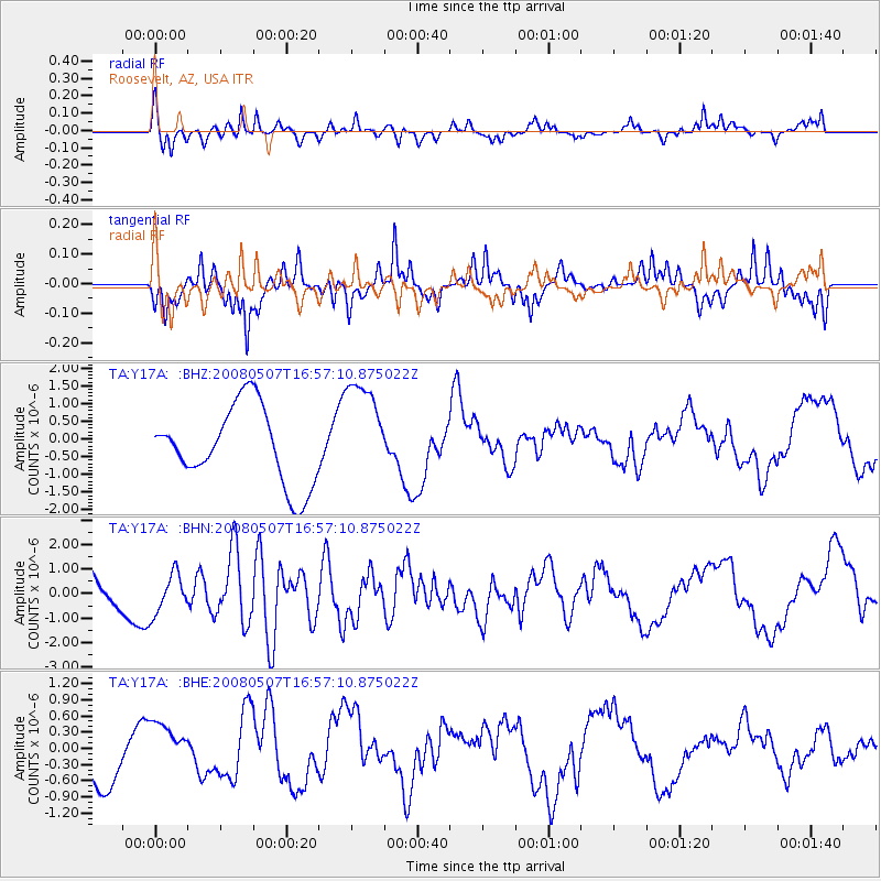
Earthquake location: Near East Coast Of Honshu, Japan
Earthquake latitude/longitude: 36.2/141.5
Earthquake time(UTC): 2008/05/07 (128) 16:45:20 GMT
Earthquake Depth: 39 km
Earthquake Magnitude: 6.1 MB, 6.7 MS, 6.8 MW, 6.8 MW
Earthquake Catalog/Contributor: WHDF/NEIC
Network: TA USArray Transportable Network (new EarthScope stations)
Station: Y17A Roosevelt, AZ, USA
Lat/Lon: 33.70 N/110.84 W
Elevation: 866 m
Distance: 83.1 deg
Az: 53.16 deg
Baz: 309.026 deg
Ray Param: 0.046363045
Estimated Moho Depth: 69.5 km
Estimated Crust Vp/Vs: 1.84
Assumed Crust Vp: 6.276 km/s
Estimated Crust Vs: 3.415 km/s
Estimated Crust Poisson's Ratio: 0.29
Radial Match: 88.01394 %
Radial Bump: 308
Transverse Match: 75.54089 %
Transverse Bump: 297
SOD ConfigId: 2504
Insert Time: 2010-03-06 14:25:38.760 +0000
GWidth: 2.5
Max Bumps: 400
Tol: 0.001

Signal To Noise

ChannelStoNSTALTA
TA:Y17A: :BHN:20080507T16:57:10.875022Z1.00138318.0157866E-78.004715E-7
TA:Y17A: :BHE:20080507T16:57:10.875022Z1.21259074.6841026E-73.8628883E-7
TA:Y17A: :BHZ:20080507T16:57:10.875022Z1.37932241.4857492E-61.0771587E-6
Arrivals
Ps9.5 SECOND
PpPs31 SECOND
PsPs/PpSs40 SECOND