You are here: Home > Network List > TA - USArray Transportable Network (new EarthScope stations) Stations List
> Station Y17A Roosevelt, AZ, USA > Earthquake Result Viewer
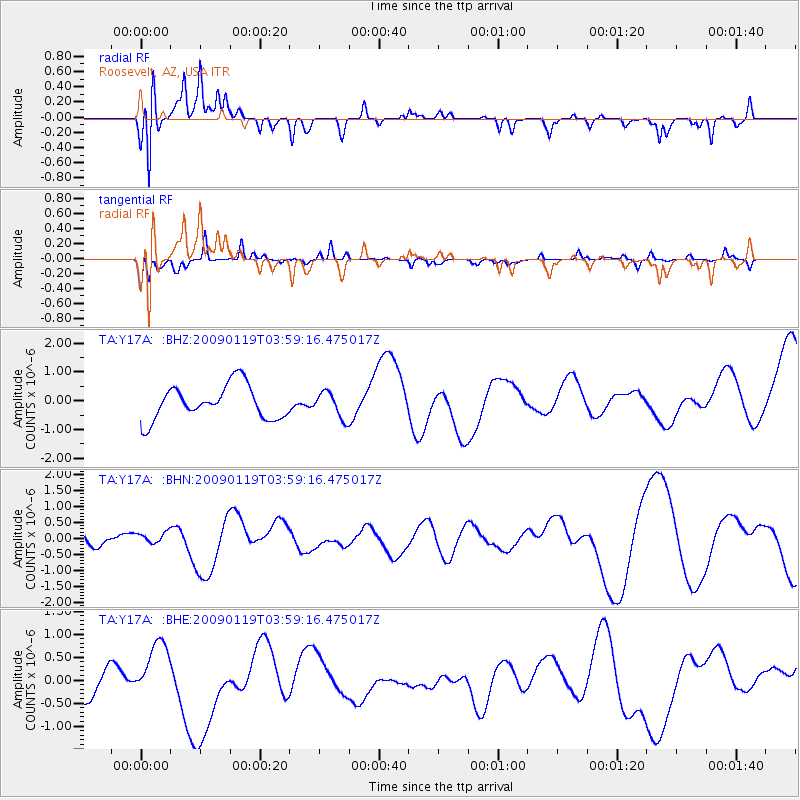
Y17A Roosevelt, AZ, USA - Earthquake Result Viewer
*The percent match for this event was below the threshold and hence no stack was calculated.
| Earthquake location: |
Southeast Of Loyalty Islands |
| Earthquake latitude/longitude: |
-22.5/170.8 |
| Earthquake time(UTC): |
2009/01/19 (019) 03:46:37 GMT |
| Earthquake Depth: |
35 km |
| Earthquake Magnitude: |
6.0 MW, 5.3 MB |
| Earthquake Catalog/Contributor: |
WHDF/NEIC |
|
| Network: |
TA USArray Transportable Network (new EarthScope stations) |
| Station: |
Y17A Roosevelt, AZ, USA |
| Lat/Lon: |
33.70 N/110.84 W |
| Elevation: |
866 m |
|
| Distance: |
93.1 deg |
| Az: |
54.859 deg |
| Baz: |
245.123 deg |
| Ray Param: |
$rayparam |
*The percent match for this event was below the threshold and hence was not used in the summary stack. |
|
| Radial Match: |
69.84946 % |
| Radial Bump: |
298 |
| Transverse Match: |
53.47264 % |
| Transverse Bump: |
337 |
| SOD ConfigId: |
2658 |
| Insert Time: |
2010-03-06 14:26:28.549 +0000 |
| GWidth: |
2.5 |
| Max Bumps: |
400 |
| Tol: |
0.001 |
|
Signal To Noise
| Channel | StoN | STA | LTA |
| TA:Y17A: :BHN:20090119T03:59:16.475017Z | 0.79069716 | 1.7924872E-7 | 2.2669707E-7 |
| TA:Y17A: :BHE:20090119T03:59:16.475017Z | 1.7092278 | 6.436348E-7 | 3.7656466E-7 |
| TA:Y17A: :BHZ:20090119T03:59:16.475017Z | 0.7671807 | 4.5323853E-7 | 5.907846E-7 |
| Arrivals |
| Ps | |
| PpPs | |
| PsPs/PpSs | |


