You are here: Home > Network List > AV - Alaska Volcano Observatory Stations List
> Station SPCR Ckakachatna River, Mount Spurr, Alaska > Earthquake Result Viewer
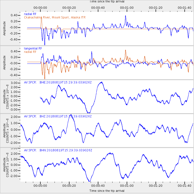
SPCR Ckakachatna River, Mount Spurr, Alaska - Earthquake Result Viewer
*The percent match for this event was below the threshold and hence no stack was calculated.
| Earthquake location: |
Sumbawa Region, Indonesia |
| Earthquake latitude/longitude: |
-8.4/116.6 |
| Earthquake time(UTC): |
2018/08/19 (231) 15:16:34 GMT |
| Earthquake Depth: |
10 km |
| Earthquake Magnitude: |
5.9 mb |
| Earthquake Catalog/Contributor: |
NEIC PDE/us |
|
| Network: |
AV Alaska Volcano Observatory |
| Station: |
SPCR Ckakachatna River, Mount Spurr, Alaska |
| Lat/Lon: |
61.20 N/152.21 W |
| Elevation: |
984 m |
|
| Distance: |
97.9 deg |
| Az: |
29.259 deg |
| Baz: |
266.957 deg |
| Ray Param: |
$rayparam |
*The percent match for this event was below the threshold and hence was not used in the summary stack. |
|
| Radial Match: |
58.542927 % |
| Radial Bump: |
400 |
| Transverse Match: |
44.861427 % |
| Transverse Bump: |
387 |
| SOD ConfigId: |
13570011 |
| Insert Time: |
2019-04-30 22:07:19.635 +0000 |
| GWidth: |
2.5 |
| Max Bumps: |
400 |
| Tol: |
0.001 |
|
Signal To Noise
| Channel | StoN | STA | LTA |
| AV:SPCR: :BHZ:20180819T15:29:39.039026Z | 0.83653253 | 8.9059034E-7 | 1.0646213E-6 |
| AV:SPCR: :BHN:20180819T15:29:39.039026Z | 1.2015725 | 1.2071283E-6 | 1.0046238E-6 |
| AV:SPCR: :BHE:20180819T15:29:39.039026Z | 2.3546002 | 2.6359162E-6 | 1.1194751E-6 |
| Arrivals |
| Ps | |
| PpPs | |
| PsPs/PpSs | |


