
T19A Beclabito, NM, USA - Earthquake Result Viewer
| ||||||||||||||||||
| ||||||||||||||||||
| ||||||||||||||||||
|
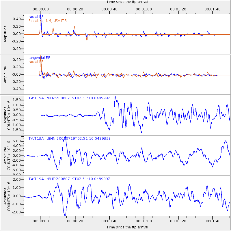
Signal To Noise
| Channel | StoN | STA | LTA |
| TA:T19A: :BHN:20080719T02:51:10.048999Z | 6.895295 | 5.70297E-7 | 8.270814E-8 |
| TA:T19A: :BHE:20080719T02:51:10.048999Z | 2.9457293 | 1.7360324E-7 | 5.8933875E-8 |
| TA:T19A: :BHZ:20080719T02:51:10.048999Z | 2.8428571 | 1.7856276E-7 | 6.2811026E-8 |
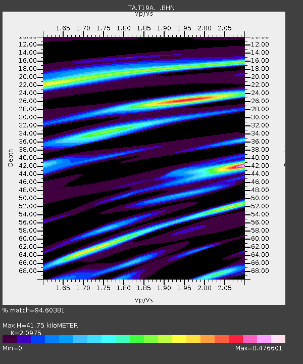
| Arrivals | |
| Ps | 7.2 SECOND |
| PpPs | 20 SECOND |
| PsPs/PpSs | 27 SECOND |

