You are here: Home > Network List > TA - USArray Transportable Network (new EarthScope stations) Stations List
> Station T19A Beclabito, NM, USA > Earthquake Result Viewer
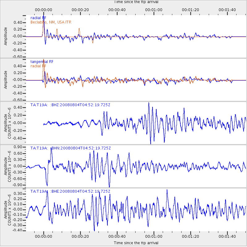
T19A Beclabito, NM, USA - Earthquake Result Viewer

| Earthquake location: |
Kuril Islands |
| Earthquake latitude/longitude: |
49.9/156.4 |
| Earthquake time(UTC): |
2008/08/04 (217) 04:42:14 GMT |
| Earthquake Depth: |
77 km |
| Earthquake Magnitude: |
5.6 MB, 5.8 MW, 5.7 MW |
| Earthquake Catalog/Contributor: |
WHDF/NEIC |
|
| Network: |
TA USArray Transportable Network (new EarthScope stations) |
| Station: |
T19A Beclabito, NM, USA |
| Lat/Lon: |
36.83 N/109.02 W |
| Elevation: |
1736 m |
|
| Distance: |
65.6 deg |
| Az: |
61.439 deg |
| Baz: |
314.881 deg |
| Ray Param: |
0.05798473 |
| Estimated Moho Depth: |
23.25 km |
| Estimated Crust Vp/Vs: |
1.60 |
| Assumed Crust Vp: |
6.476 km/s |
| Estimated Crust Vs: |
4.047 km/s |
| Estimated Crust Poisson's Ratio: |
0.18 |
|
| Radial Match: |
90.80362 % |
| Radial Bump: |
400 |
| Transverse Match: |
76.9231 % |
| Transverse Bump: |
400 |
| SOD ConfigId: |
2504 |
| Insert Time: |
2010-03-06 14:26:58.750 +0000 |
| GWidth: |
2.5 |
| Max Bumps: |
400 |
| Tol: |
0.001 |
|
Signal To Noise
| Channel | StoN | STA | LTA |
| TA:T19A: :BHN:20080804T04:52:19.725Z | 8.208111 | 4.6025693E-7 | 5.6073436E-8 |
| TA:T19A: :BHE:20080804T04:52:19.725Z | 2.7290988 | 1.6786157E-7 | 6.150806E-8 |
| TA:T19A: :BHZ:20080804T04:52:19.725Z | 4.209927 | 1.5226901E-7 | 3.6169038E-8 |
| Arrivals |
| Ps | 2.3 SECOND |
| PpPs | 8.9 SECOND |
| PsPs/PpSs | 11 SECOND |


