You are here: Home > Network List > TA - USArray Transportable Network (new EarthScope stations) Stations List
> Station F20K Avaraart Lake, AK, USA > Earthquake Result Viewer
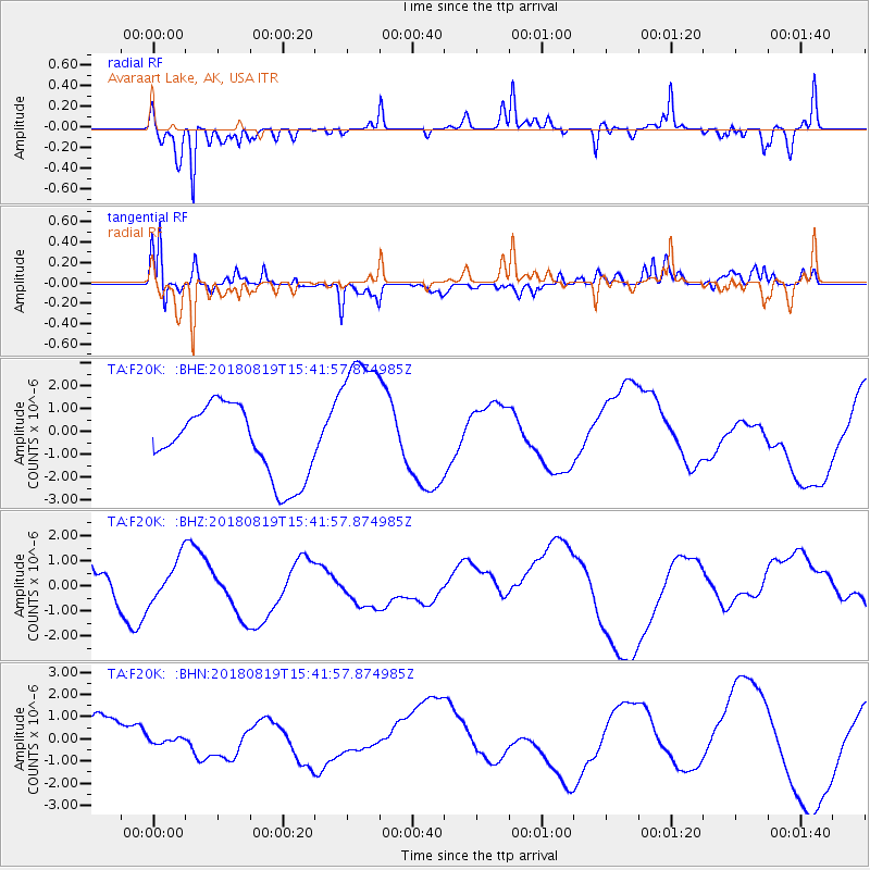
F20K Avaraart Lake, AK, USA - Earthquake Result Viewer
*The percent match for this event was below the threshold and hence no stack was calculated.
| Earthquake location: |
Sumbawa Region, Indonesia |
| Earthquake latitude/longitude: |
-8.4/116.6 |
| Earthquake time(UTC): |
2018/08/19 (231) 15:28:58 GMT |
| Earthquake Depth: |
10 km |
| Earthquake Magnitude: |
5.5 mb |
| Earthquake Catalog/Contributor: |
NEIC PDE/us |
|
| Network: |
TA USArray Transportable Network (new EarthScope stations) |
| Station: |
F20K Avaraart Lake, AK, USA |
| Lat/Lon: |
67.05 N/155.73 W |
| Elevation: |
136 m |
|
| Distance: |
96.8 deg |
| Az: |
23.243 deg |
| Baz: |
264.599 deg |
| Ray Param: |
$rayparam |
*The percent match for this event was below the threshold and hence was not used in the summary stack. |
|
| Radial Match: |
72.02647 % |
| Radial Bump: |
314 |
| Transverse Match: |
54.773 % |
| Transverse Bump: |
400 |
| SOD ConfigId: |
13570011 |
| Insert Time: |
2019-04-30 22:10:51.526 +0000 |
| GWidth: |
2.5 |
| Max Bumps: |
400 |
| Tol: |
0.001 |
|
Signal To Noise
| Channel | StoN | STA | LTA |
| TA:F20K: :BHZ:20180819T15:41:57.874985Z | 0.8412997 | 8.3215593E-7 | 9.891313E-7 |
| TA:F20K: :BHN:20180819T15:41:57.874985Z | 0.1725089 | 1.17910794E-7 | 6.835056E-7 |
| TA:F20K: :BHE:20180819T15:41:57.874985Z | 2.1052961 | 3.19446E-6 | 1.5173447E-6 |
| Arrivals |
| Ps | |
| PpPs | |
| PsPs/PpSs | |


