T19A Beclabito, NM, USA - Earthquake Result Viewer
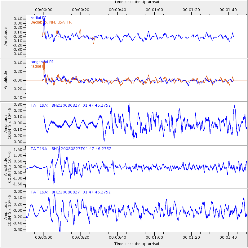
Earthquake location: Lake Baykal Region, Russia
Earthquake latitude/longitude: 51.6/104.2
Earthquake time(UTC): 2008/08/27 (240) 01:35:32 GMT
Earthquake Depth: 16 km
Earthquake Magnitude: 5.8 MB, 6.2 MS, 6.2 MW, 6.2 MW
Earthquake Catalog/Contributor: WHDF/NEIC
Network: TA USArray Transportable Network (new EarthScope stations)
Station: T19A Beclabito, NM, USA
Lat/Lon: 36.83 N/109.02 W
Elevation: 1736 m
Distance: 87.3 deg
Az: 26.081 deg
Baz: 340.019 deg
Ray Param: 0.04344137
Estimated Moho Depth: 22.0 km
Estimated Crust Vp/Vs: 1.64
Assumed Crust Vp: 6.476 km/s
Estimated Crust Vs: 3.937 km/s
Estimated Crust Poisson's Ratio: 0.21
Radial Match: 82.84283 %
Radial Bump: 357
Transverse Match: 64.85221 %
Transverse Bump: 400
SOD ConfigId: 2504
Insert Time: 2010-03-06 14:27:07.273 +0000
GWidth: 2.5
Max Bumps: 400
Tol: 0.001

Signal To Noise

ChannelStoNSTALTA
TA:T19A: :BHN:20080827T01:47:46.275Z6.5023654.3883153E-76.748799E-8
TA:T19A: :BHE:20080827T01:47:46.275Z2.57478281.9672026E-77.640267E-8
TA:T19A: :BHZ:20080827T01:47:46.275Z2.53798821.2309293E-74.8500198E-8
Arrivals
Ps2.2 SECOND
PpPs8.8 SECOND
PsPs/PpSs11 SECOND