You are here: Home > Network List > IU - Global Seismograph Network (GSN - IRIS/USGS) Stations List
> Station CTAO Charters Towers, Australia > Earthquake Result Viewer
CTAO Charters Towers, Australia - Earthquake Result Viewer
*The percent match for this event was below the threshold and hence no stack was calculated.
| Earthquake location: |
Southwestern Ryukyu Isl., Japan |
| Earthquake latitude/longitude: |
23.6/123.4 |
| Earthquake time(UTC): |
2016/06/23 (175) 21:05:29 GMT |
| Earthquake Depth: |
10 km |
| Earthquake Magnitude: |
5.9 MWP |
| Earthquake Catalog/Contributor: |
NEIC PDE/NEIC COMCAT |
|
| Network: |
IU Global Seismograph Network (GSN - IRIS/USGS) |
| Station: |
CTAO Charters Towers, Australia |
| Lat/Lon: |
20.09 S/146.25 E |
| Elevation: |
357 m |
|
| Distance: |
48.8 deg |
| Az: |
150.97 deg |
| Baz: |
331.734 deg |
| Ray Param: |
$rayparam |
*The percent match for this event was below the threshold and hence was not used in the summary stack. |
|
| Radial Match: |
52.232903 % |
| Radial Bump: |
360 |
| Transverse Match: |
62.518375 % |
| Transverse Bump: |
400 |
| SOD ConfigId: |
1634031 |
| Insert Time: |
2016-07-07 21:07:48.418 +0000 |
| GWidth: |
2.5 |
| Max Bumps: |
400 |
| Tol: |
0.001 |
|
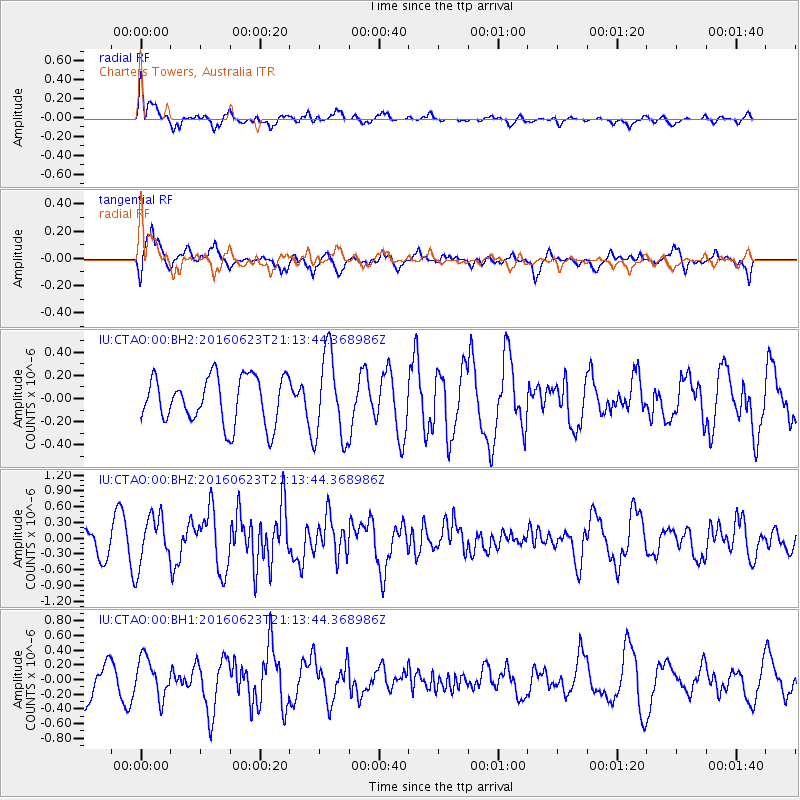
Signal To Noise
| Channel | StoN | STA | LTA |
| IU:CTAO:00:BHZ:20160623T21:13:44.368986Z | 1.9918146 | 4.5833343E-7 | 2.3010847E-7 |
| IU:CTAO:00:BH1:20160623T21:13:44.368986Z | 1.1724238 | 2.6712186E-7 | 2.2783729E-7 |
| IU:CTAO:00:BH2:20160623T21:13:44.368986Z | 1.8279033 | 3.7013086E-7 | 2.0248932E-7 |
| Arrivals |
| Ps | |
| PpPs | |
| PsPs/PpSs | |


