T19A Beclabito, NM, USA - Earthquake Result Viewer
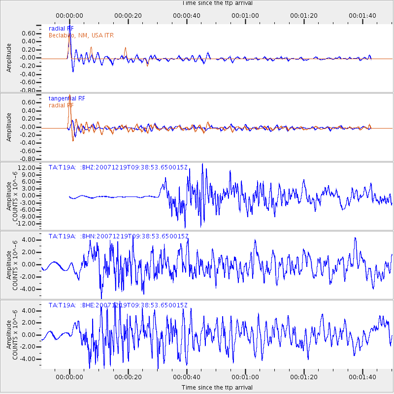
Earthquake location: Andreanof Islands, Aleutian Is.
Earthquake latitude/longitude: 51.4/-179.5
Earthquake time(UTC): 2007/12/19 (353) 09:30:27 GMT
Earthquake Depth: 29 km
Earthquake Magnitude: 6.4 MB, 7.1 MS, 7.1 MW, 7.0 MW
Earthquake Catalog/Contributor: WHDF/NEIC
Network: TA USArray Transportable Network (new EarthScope stations)
Station: T19A Beclabito, NM, USA
Lat/Lon: 36.83 N/109.02 W
Elevation: 1736 m
Distance: 50.7 deg
Az: 77.656 deg
Baz: 310.242 deg
Ray Param: 0.06780383
Estimated Moho Depth: 13.5 km
Estimated Crust Vp/Vs: 2.10
Assumed Crust Vp: 6.476 km/s
Estimated Crust Vs: 3.087 km/s
Estimated Crust Poisson's Ratio: 0.35
Radial Match: 91.91832 %
Radial Bump: 400
Transverse Match: 70.39918 %
Transverse Bump: 400
SOD ConfigId: 2564
Insert Time: 2010-03-06 14:27:25.577 +0000
GWidth: 2.5
Max Bumps: 400
Tol: 0.001

Signal To Noise

ChannelStoNSTALTA
TA:T19A: :BHN:20071219T09:38:53.650015Z3.25920929.981795E-73.0626433E-7
TA:T19A: :BHE:20071219T09:38:53.650015Z3.24159621.2297028E-63.79351E-7
TA:T19A: :BHZ:20071219T09:38:53.650015Z12.1439193.401104E-62.8006644E-7
Arrivals
Ps2.4 SECOND
PpPs6.1 SECOND
PsPs/PpSs8.6 SECOND