You are here: Home > Network List > UW - Pacific Northwest Regional Seismic Network Stations List
> Station LEBA Lebam, WA, USA > Earthquake Result Viewer
LEBA Lebam, WA, USA - Earthquake Result Viewer
*The percent match for this event was below the threshold and hence no stack was calculated.
| Earthquake location: |
Fiji Islands Region |
| Earthquake latitude/longitude: |
-18.2/-178.2 |
| Earthquake time(UTC): |
2018/08/20 (232) 08:38:00 GMT |
| Earthquake Depth: |
528 km |
| Earthquake Magnitude: |
5.5 Mww |
| Earthquake Catalog/Contributor: |
NEIC PDE/us |
|
| Network: |
UW Pacific Northwest Regional Seismic Network |
| Station: |
LEBA Lebam, WA, USA |
| Lat/Lon: |
46.55 N/123.56 W |
| Elevation: |
73 m |
|
| Distance: |
81.1 deg |
| Az: |
34.718 deg |
| Baz: |
231.646 deg |
| Ray Param: |
$rayparam |
*The percent match for this event was below the threshold and hence was not used in the summary stack. |
|
| Radial Match: |
67.2961 % |
| Radial Bump: |
400 |
| Transverse Match: |
48.737453 % |
| Transverse Bump: |
400 |
| SOD ConfigId: |
13570011 |
| Insert Time: |
2019-04-30 22:18:48.320 +0000 |
| GWidth: |
2.5 |
| Max Bumps: |
400 |
| Tol: |
0.001 |
|
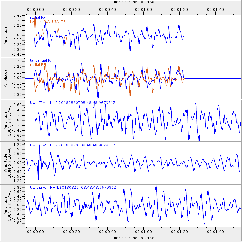
Signal To Noise
| Channel | StoN | STA | LTA |
| UW:LEBA: :HHZ:20180820T08:48:48.967981Z | 2.0725787 | 4.912694E-7 | 2.3703295E-7 |
| UW:LEBA: :HHN:20180820T08:48:48.967981Z | 0.8813445 | 2.635521E-7 | 2.9903416E-7 |
| UW:LEBA: :HHE:20180820T08:48:48.967981Z | 1.6307225 | 4.2328293E-7 | 2.595677E-7 |
| Arrivals |
| Ps | |
| PpPs | |
| PsPs/PpSs | |


