You are here: Home > Network List > TA - USArray Transportable Network (new EarthScope stations) Stations List
> Station T19A Beclabito, NM, USA > Earthquake Result Viewer
T19A Beclabito, NM, USA - Earthquake Result Viewer
*The percent match for this event was below the threshold and hence no stack was calculated.
| Earthquake location: |
South Of Mariana Islands |
| Earthquake latitude/longitude: |
13.8/146.3 |
| Earthquake time(UTC): |
2009/02/24 (055) 05:57:59 GMT |
| Earthquake Depth: |
5.0 km |
| Earthquake Magnitude: |
5.7 MB, 5.7 MS, 5.9 MW, 5.8 MW |
| Earthquake Catalog/Contributor: |
WHDF/NEIC |
|
| Network: |
TA USArray Transportable Network (new EarthScope stations) |
| Station: |
T19A Beclabito, NM, USA |
| Lat/Lon: |
36.83 N/109.02 W |
| Elevation: |
1736 m |
|
| Distance: |
93.2 deg |
| Az: |
51.025 deg |
| Baz: |
289.717 deg |
| Ray Param: |
$rayparam |
*The percent match for this event was below the threshold and hence was not used in the summary stack. |
|
| Radial Match: |
62.91769 % |
| Radial Bump: |
400 |
| Transverse Match: |
52.014145 % |
| Transverse Bump: |
400 |
| SOD ConfigId: |
2658 |
| Insert Time: |
2010-03-06 14:28:33.275 +0000 |
| GWidth: |
2.5 |
| Max Bumps: |
400 |
| Tol: |
0.001 |
|
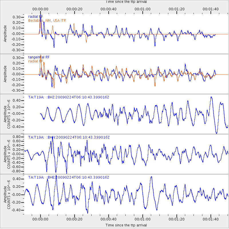
Signal To Noise
| Channel | StoN | STA | LTA |
| TA:T19A: :BHN:20090224T06:10:43.399016Z | 1.7225282 | 2.6706115E-7 | 1.5504021E-7 |
| TA:T19A: :BHE:20090224T06:10:43.399016Z | 1.5878723 | 2.0785798E-7 | 1.3090346E-7 |
| TA:T19A: :BHZ:20090224T06:10:43.399016Z | 0.6091809 | 9.204664E-8 | 1.5109902E-7 |
| Arrivals |
| Ps | |
| PpPs | |
| PsPs/PpSs | |


