You are here: Home > Network List > TA - USArray Transportable Network (new EarthScope stations) Stations List
> Station T19A Beclabito, NM, USA > Earthquake Result Viewer
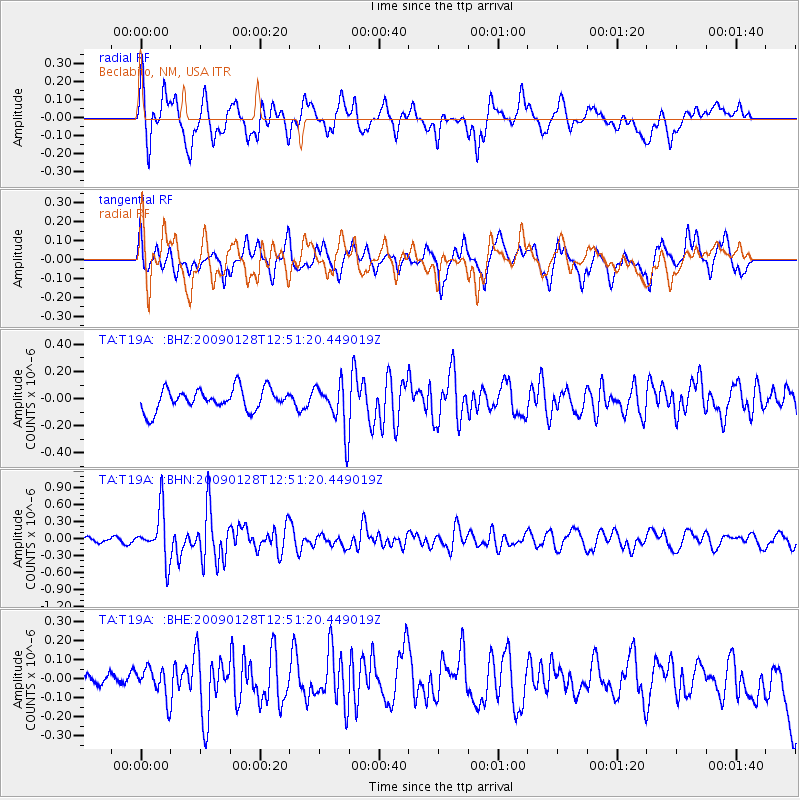
T19A Beclabito, NM, USA - Earthquake Result Viewer
*The percent match for this event was below the threshold and hence no stack was calculated.
| Earthquake location: |
Samoa Islands Region |
| Earthquake latitude/longitude: |
-17.0/-172.1 |
| Earthquake time(UTC): |
2009/01/28 (028) 12:39:42 GMT |
| Earthquake Depth: |
10 km |
| Earthquake Magnitude: |
5.6 MB, 5.3 MS, 5.5 MW |
| Earthquake Catalog/Contributor: |
WHDF/NEIC |
|
| Network: |
TA USArray Transportable Network (new EarthScope stations) |
| Station: |
T19A Beclabito, NM, USA |
| Lat/Lon: |
36.83 N/109.02 W |
| Elevation: |
1736 m |
|
| Distance: |
79.9 deg |
| Az: |
46.583 deg |
| Baz: |
240.039 deg |
| Ray Param: |
$rayparam |
*The percent match for this event was below the threshold and hence was not used in the summary stack. |
|
| Radial Match: |
67.85454 % |
| Radial Bump: |
400 |
| Transverse Match: |
66.90819 % |
| Transverse Bump: |
400 |
| SOD ConfigId: |
2658 |
| Insert Time: |
2010-03-06 14:28:38.732 +0000 |
| GWidth: |
2.5 |
| Max Bumps: |
400 |
| Tol: |
0.001 |
|
Signal To Noise
| Channel | StoN | STA | LTA |
| TA:T19A: :BHN:20090128T12:51:20.449019Z | 5.864359 | 4.367598E-7 | 7.4476986E-8 |
| TA:T19A: :BHE:20090128T12:51:20.449019Z | 1.1076717 | 8.2311125E-8 | 7.431004E-8 |
| TA:T19A: :BHZ:20090128T12:51:20.449019Z | 2.215941 | 1.7517534E-7 | 7.905235E-8 |
| Arrivals |
| Ps | |
| PpPs | |
| PsPs/PpSs | |


