You are here: Home > Network List > TA - USArray Transportable Network (new EarthScope stations) Stations List
> Station T19A Beclabito, NM, USA > Earthquake Result Viewer
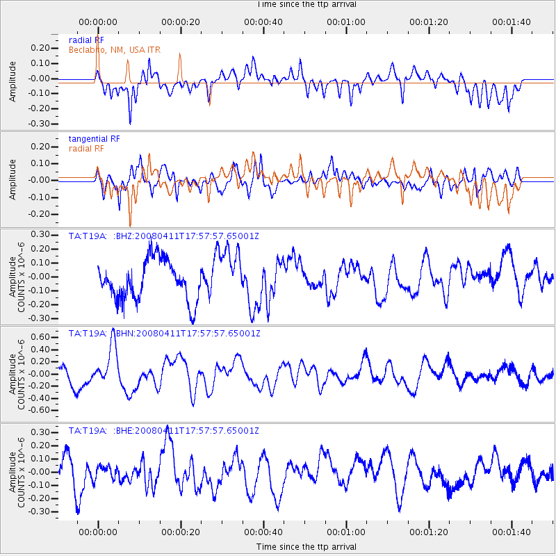
T19A Beclabito, NM, USA - Earthquake Result Viewer
*The percent match for this event was below the threshold and hence no stack was calculated.
| Earthquake location: |
Loyalty Islands |
| Earthquake latitude/longitude: |
-20.4/168.8 |
| Earthquake time(UTC): |
2008/04/11 (102) 17:45:05 GMT |
| Earthquake Depth: |
35 km |
| Earthquake Magnitude: |
5.7 MB, 5.9 MS, 6.0 MW, 6.0 MW |
| Earthquake Catalog/Contributor: |
WHDF/NEIC |
|
| Network: |
TA USArray Transportable Network (new EarthScope stations) |
| Station: |
T19A Beclabito, NM, USA |
| Lat/Lon: |
36.83 N/109.02 W |
| Elevation: |
1736 m |
|
| Distance: |
96.0 deg |
| Az: |
53.053 deg |
| Baz: |
249.12 deg |
| Ray Param: |
$rayparam |
*The percent match for this event was below the threshold and hence was not used in the summary stack. |
|
| Radial Match: |
69.625824 % |
| Radial Bump: |
400 |
| Transverse Match: |
55.755905 % |
| Transverse Bump: |
400 |
| SOD ConfigId: |
2504 |
| Insert Time: |
2010-03-06 14:28:41.213 +0000 |
| GWidth: |
2.5 |
| Max Bumps: |
400 |
| Tol: |
0.001 |
|
Signal To Noise
| Channel | StoN | STA | LTA |
| TA:T19A: :BHN:20080411T17:57:57.65001Z | 1.9968517 | 3.36461E-7 | 1.6849575E-7 |
| TA:T19A: :BHE:20080411T17:57:57.65001Z | 0.50495815 | 4.6015884E-8 | 9.1128115E-8 |
| TA:T19A: :BHZ:20080411T17:57:57.65001Z | 1.3648673 | 1.9086598E-7 | 1.3984214E-7 |
| Arrivals |
| Ps | |
| PpPs | |
| PsPs/PpSs | |


