You are here: Home > Network List > TA - USArray Transportable Network (new EarthScope stations) Stations List
> Station T19A Beclabito, NM, USA > Earthquake Result Viewer
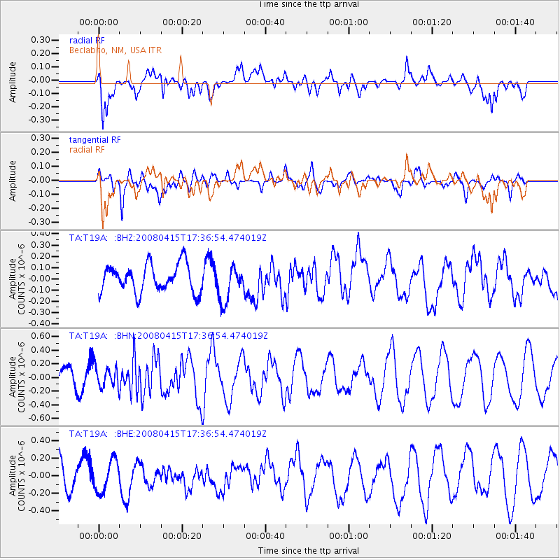
T19A Beclabito, NM, USA - Earthquake Result Viewer
*The percent match for this event was below the threshold and hence no stack was calculated.
| Earthquake location: |
Tonga Islands |
| Earthquake latitude/longitude: |
-18.7/-176.0 |
| Earthquake time(UTC): |
2008/04/15 (106) 17:24:56 GMT |
| Earthquake Depth: |
10 km |
| Earthquake Magnitude: |
5.5 MB, 5.5 MS, 5.7 MW, 5.6 MW |
| Earthquake Catalog/Contributor: |
WHDF/NEIC |
|
| Network: |
TA USArray Transportable Network (new EarthScope stations) |
| Station: |
T19A Beclabito, NM, USA |
| Lat/Lon: |
36.83 N/109.02 W |
| Elevation: |
1736 m |
|
| Distance: |
83.8 deg |
| Az: |
47.947 deg |
| Baz: |
241.308 deg |
| Ray Param: |
$rayparam |
*The percent match for this event was below the threshold and hence was not used in the summary stack. |
|
| Radial Match: |
87.99018 % |
| Radial Bump: |
400 |
| Transverse Match: |
52.910034 % |
| Transverse Bump: |
400 |
| SOD ConfigId: |
2504 |
| Insert Time: |
2010-03-06 14:28:42.468 +0000 |
| GWidth: |
2.5 |
| Max Bumps: |
400 |
| Tol: |
0.001 |
|
Signal To Noise
| Channel | StoN | STA | LTA |
| TA:T19A: :BHN:20080415T17:36:54.474019Z | 0.89785045 | 1.3808744E-7 | 1.5379781E-7 |
| TA:T19A: :BHE:20080415T17:36:54.474019Z | 1.2952591 | 1.8384996E-7 | 1.4194067E-7 |
| TA:T19A: :BHZ:20080415T17:36:54.474019Z | 1.3240266 | 1.6155204E-7 | 1.220157E-7 |
| Arrivals |
| Ps | |
| PpPs | |
| PsPs/PpSs | |


