You are here: Home > Network List > TA - USArray Transportable Network (new EarthScope stations) Stations List
> Station T19A Beclabito, NM, USA > Earthquake Result Viewer
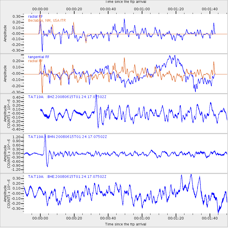
T19A Beclabito, NM, USA - Earthquake Result Viewer
*The percent match for this event was below the threshold and hence no stack was calculated.
| Earthquake location: |
Fiji Islands Region |
| Earthquake latitude/longitude: |
-17.7/-179.7 |
| Earthquake time(UTC): |
2008/06/15 (167) 01:13:11 GMT |
| Earthquake Depth: |
611 km |
| Earthquake Magnitude: |
5.5 MB, 5.9 MW, 5.9 MW |
| Earthquake Catalog/Contributor: |
WHDF/NEIC |
|
| Network: |
TA USArray Transportable Network (new EarthScope stations) |
| Station: |
T19A Beclabito, NM, USA |
| Lat/Lon: |
36.83 N/109.02 W |
| Elevation: |
1736 m |
|
| Distance: |
85.9 deg |
| Az: |
49.399 deg |
| Baz: |
244.407 deg |
| Ray Param: |
$rayparam |
*The percent match for this event was below the threshold and hence was not used in the summary stack. |
|
| Radial Match: |
59.318745 % |
| Radial Bump: |
400 |
| Transverse Match: |
47.45325 % |
| Transverse Bump: |
400 |
| SOD ConfigId: |
2504 |
| Insert Time: |
2010-03-06 14:28:47.872 +0000 |
| GWidth: |
2.5 |
| Max Bumps: |
400 |
| Tol: |
0.001 |
|
Signal To Noise
| Channel | StoN | STA | LTA |
| TA:T19A: :BHN:20080615T01:24:17.07502Z | 10.800538 | 5.786352E-7 | 5.3574666E-8 |
| TA:T19A: :BHE:20080615T01:24:17.07502Z | 1.3007143 | 1.09703265E-7 | 8.434079E-8 |
| TA:T19A: :BHZ:20080615T01:24:17.07502Z | 2.5028782 | 1.9761796E-7 | 7.895629E-8 |
| Arrivals |
| Ps | |
| PpPs | |
| PsPs/PpSs | |


